Getting to Dubrovnik
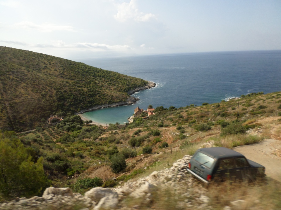
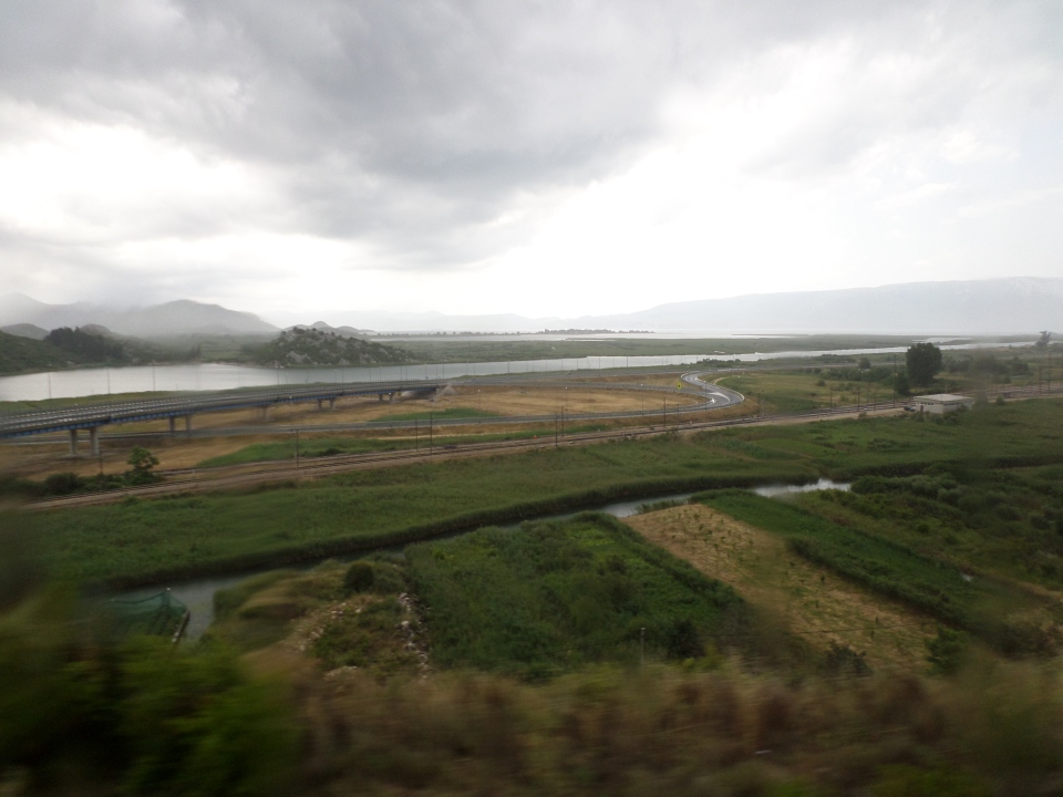
We were on the road by 8 am, on 15th June, 2018, to get to Dubrovnik via Ston. We drove back the same way that we came to Mostar, up over the hills to the south-west (I think) of the city heading for the border. We had a fairly long wait at the border, held up by the bus in front which Sibila said was Albanian registration thus likely to be Chinese tourists, who always get ‘special treatment’. It was a smooth ride thereafter, across the Narelska River delta and up the other side, hills with vineyards, olive trees, scrub and rocks. We had to go back into Bosnia- the country has sea access and so divides Croatia. This is being avoided by the building of a bridge on Croatian soil, across the opening of the bay the interior of which is Bosnian. As it was we just got waved through the border check, to cheers. The Sibila served shots of pear brandy (that I think she had kept in case it was a long wait at that border). We stopped briefly at a restaurant with lots of loos, then headed for the border out of Bosnia again. This time it took a little longer and our passports were stamped.
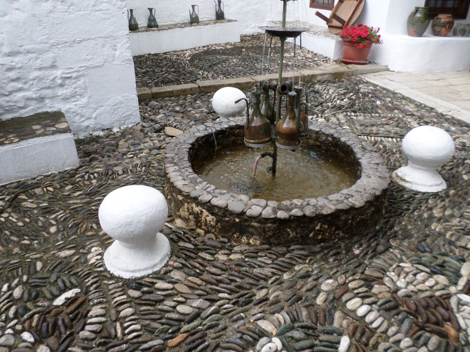
We arrived in Ston a little later than schedule, so we were herded onto a boat just big enough for all of us, to go visit some oyster beds. This was only a few minutes away, but on the voyage we were served more brandy and some sugared almonds (these are home-sugared, and do not have such a thick smooth coat as the commercial kind).
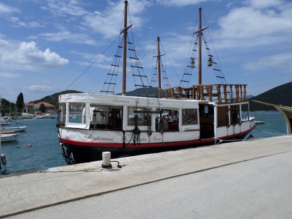
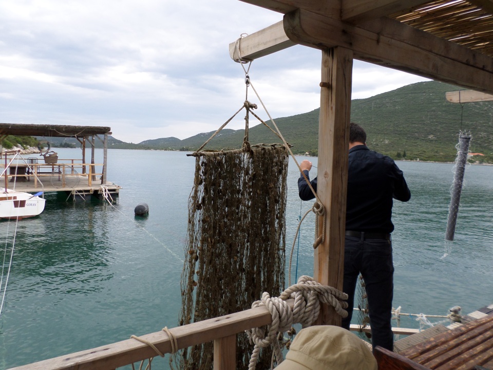
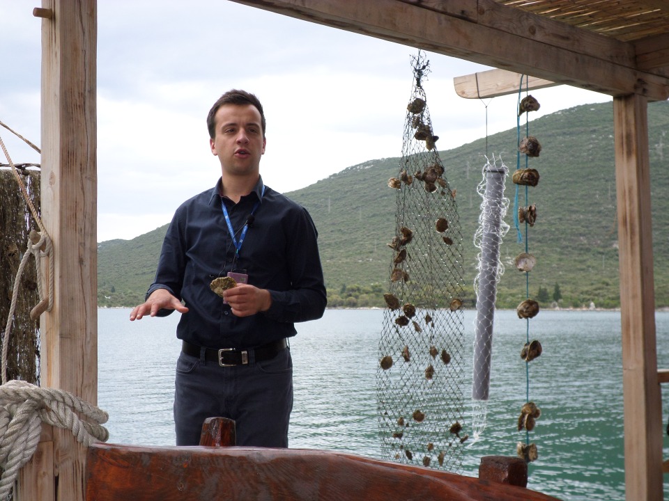
Oysters are not grown on flat wooden beds as they are in Australia, rather they start off on a vertically hung cluster of nets for a few years, then as they mature they are removed and stuck in pairs further apart on a single net until they are four years old, when they are harvested. Only 60% of the oysters survive that long. Maybe they escape the net…
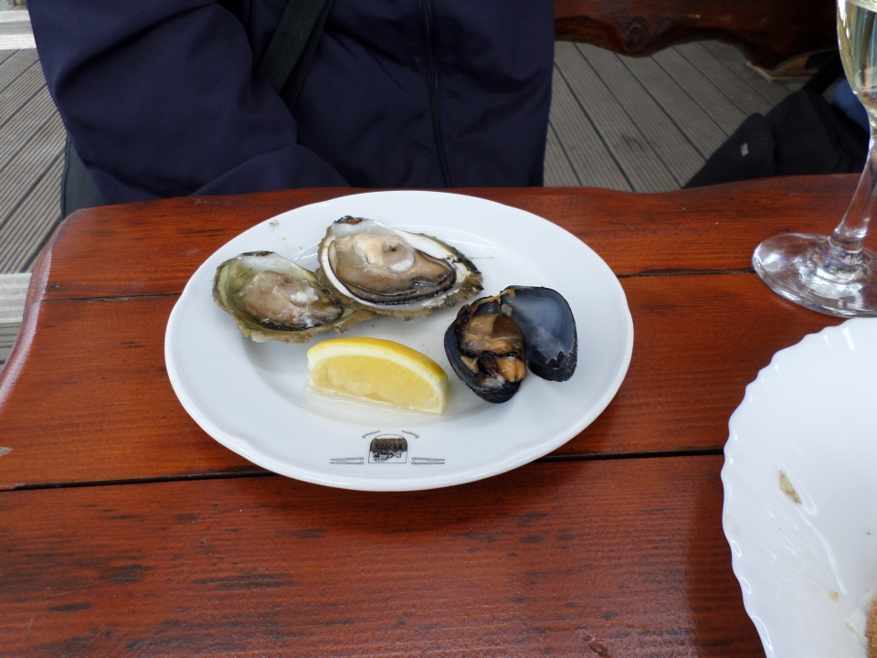
After this explanation we were served bread, wine and a tasting plate of oysters and mussels. I was brave and tried both –I lived, and sampled more.
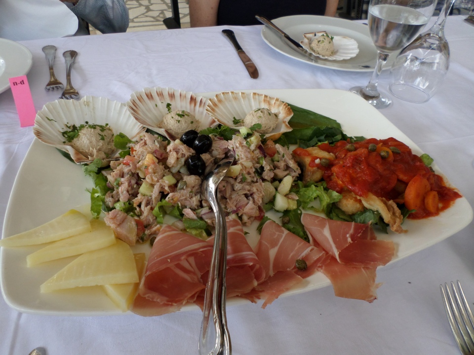
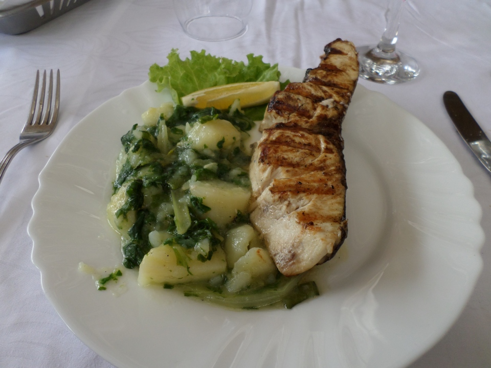
Then it was back to shore and lunch at a local restaurant. Here we had a mixed appetiser plate to share between four, and then either a meat or fish main course. I’d opted for fish, which was served with the ubiquitous potatoes and chard mixture that gets served with fish everywhere here. However it was all very good. There was more wine.
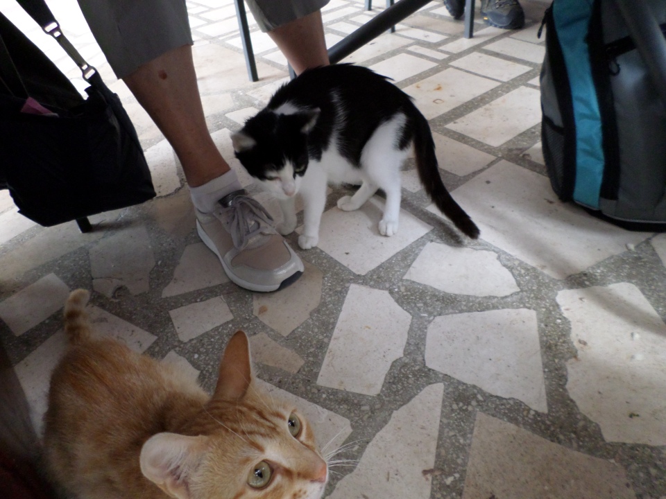
We were soon joined by a couple of cats who shared our fish.
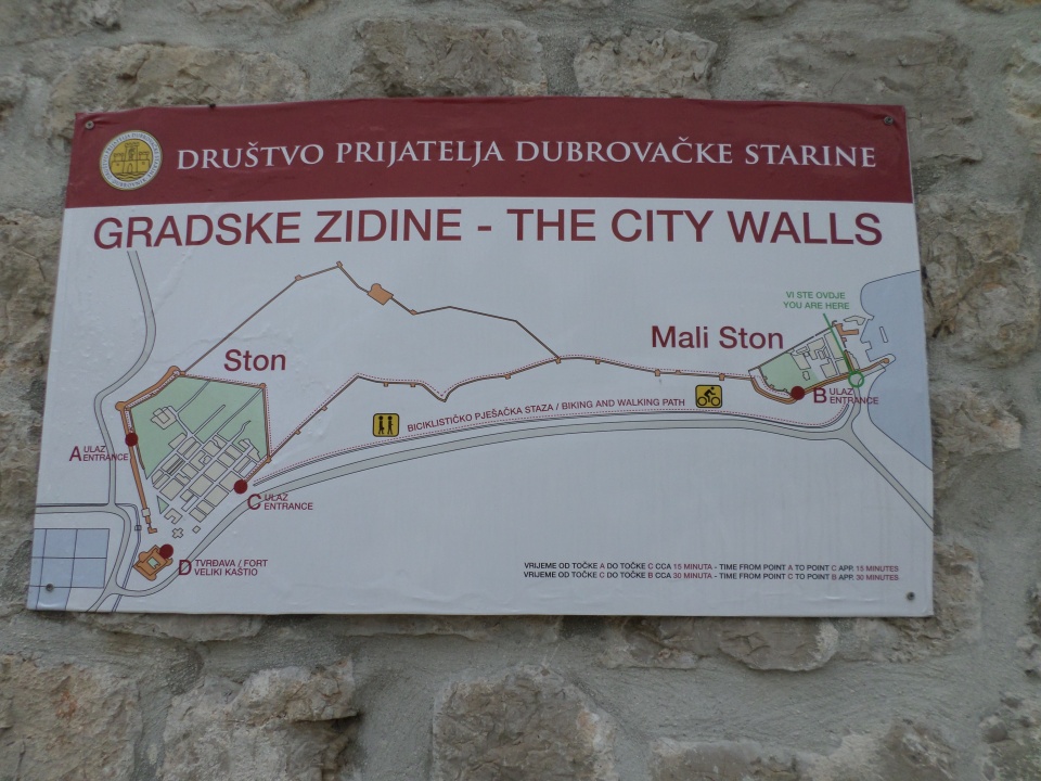
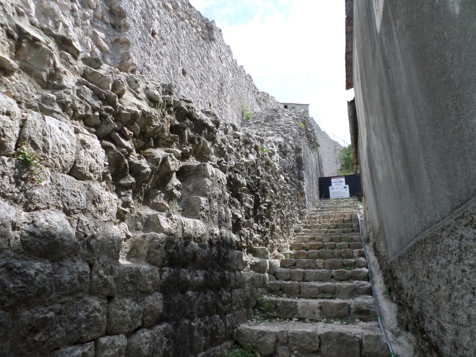
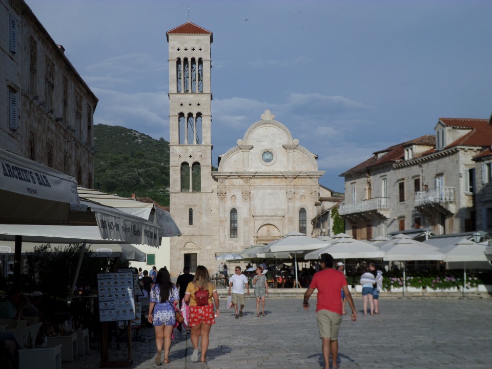
We had a little free time after lunch. The walk along the walls from Ston to Mali Ston has been removed from the program, after an Albatross traveller collapsed on the wall, in 42 degree heat, a few years ago. I was rather disappointed by this, but also somewhat daunted by the steep rise just outside of town. The walls are very thick and steep, running over the hills between the two towns as a defensive measure. We did climb up inside the walls for part of the way, to a small church, and had a good view back over the town to the oyster beds.
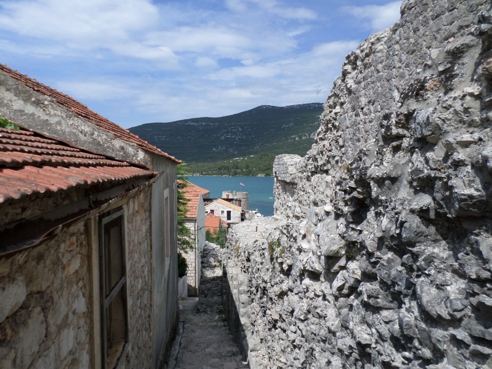
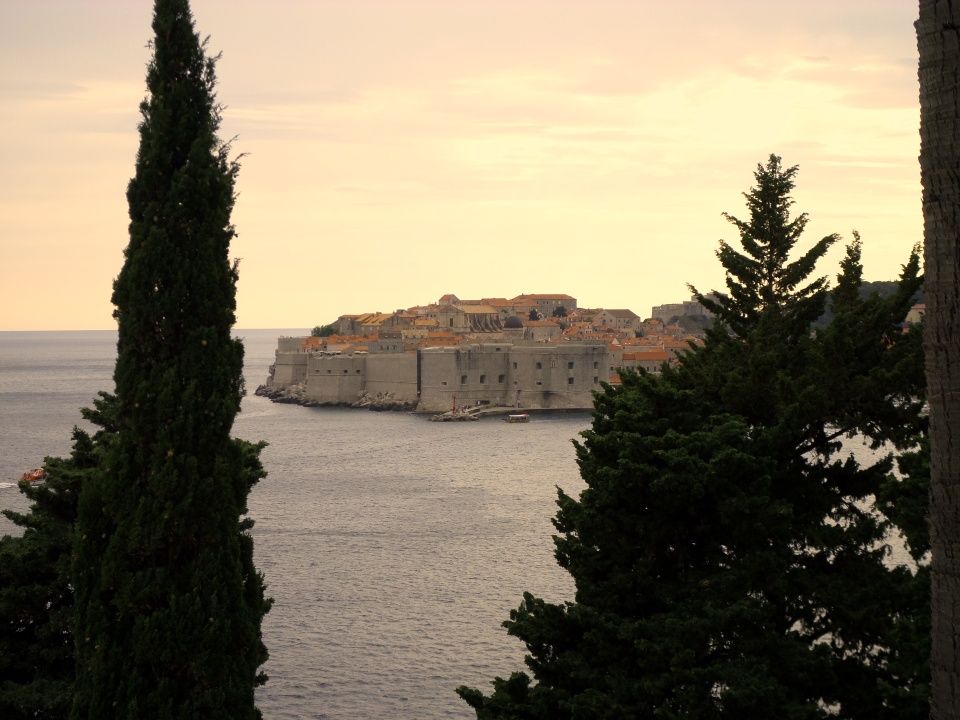
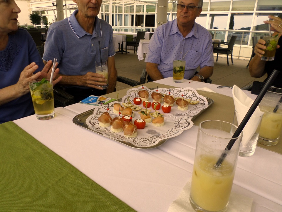
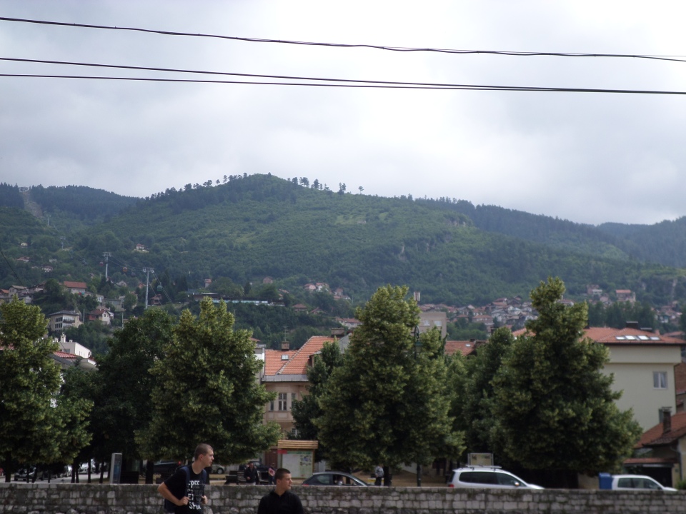
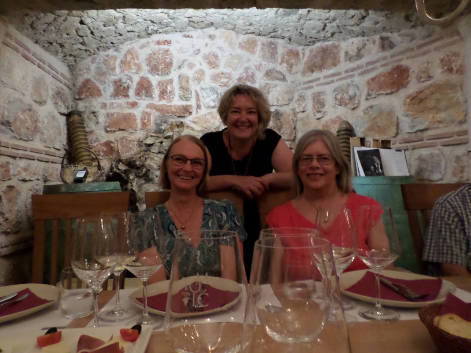
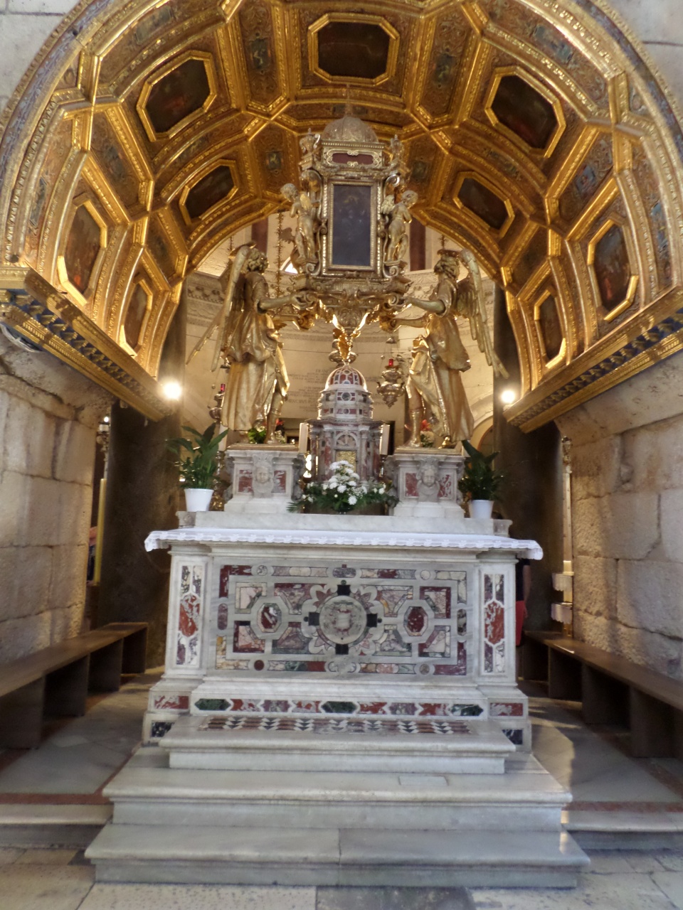
I slept for much of the remaining distance to Dubrovnik, waking up as we neared the walls – they are huge! That evening we had hors d’ouvres and cocktails on the hotel terrace, with a distant view of the Old City between the Cyprus pines.
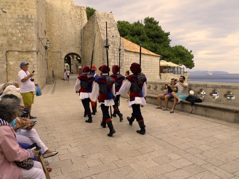
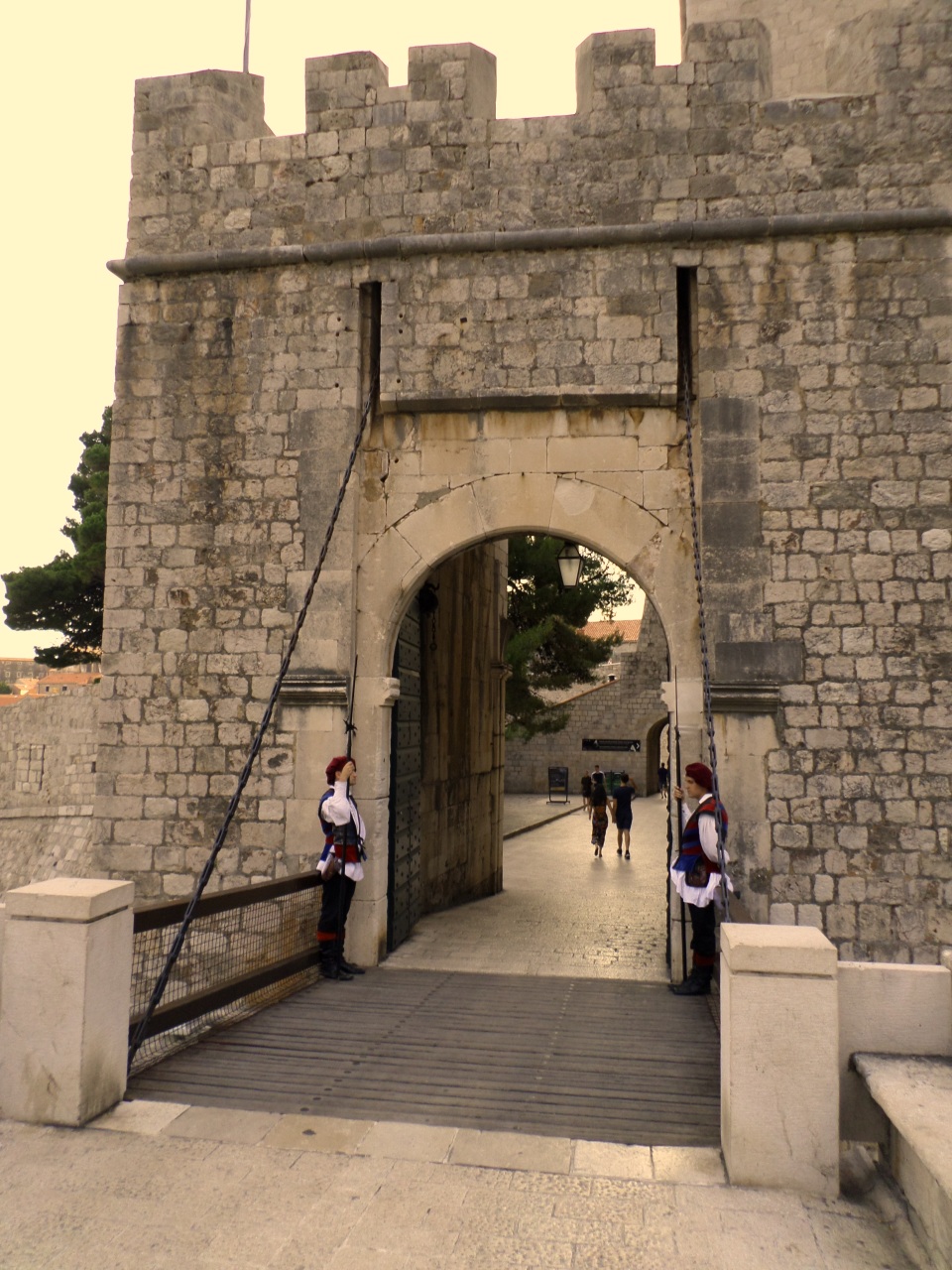
We had the evening free, so we headed down into the Old Town, I noted that the main streets run across the slop, and connections between them are steep stairways. We just caught a view of the guard being posted on the city gate, which appears to happen most days at 7 pm, as long as it isn’t raining.
We bought sandwiches (long rolls) and ate them down in the harbour watching the people and the boats. Then we wandered back to the hotel.
Sarajevo
We took a day trip to Sarajevo, on 14 June 2018, from Mostar.
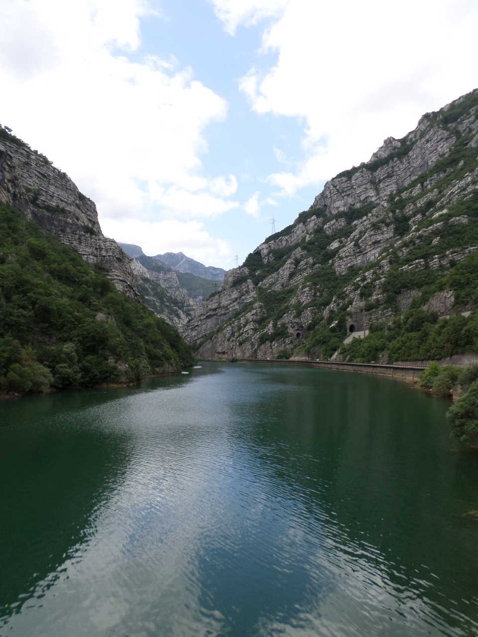
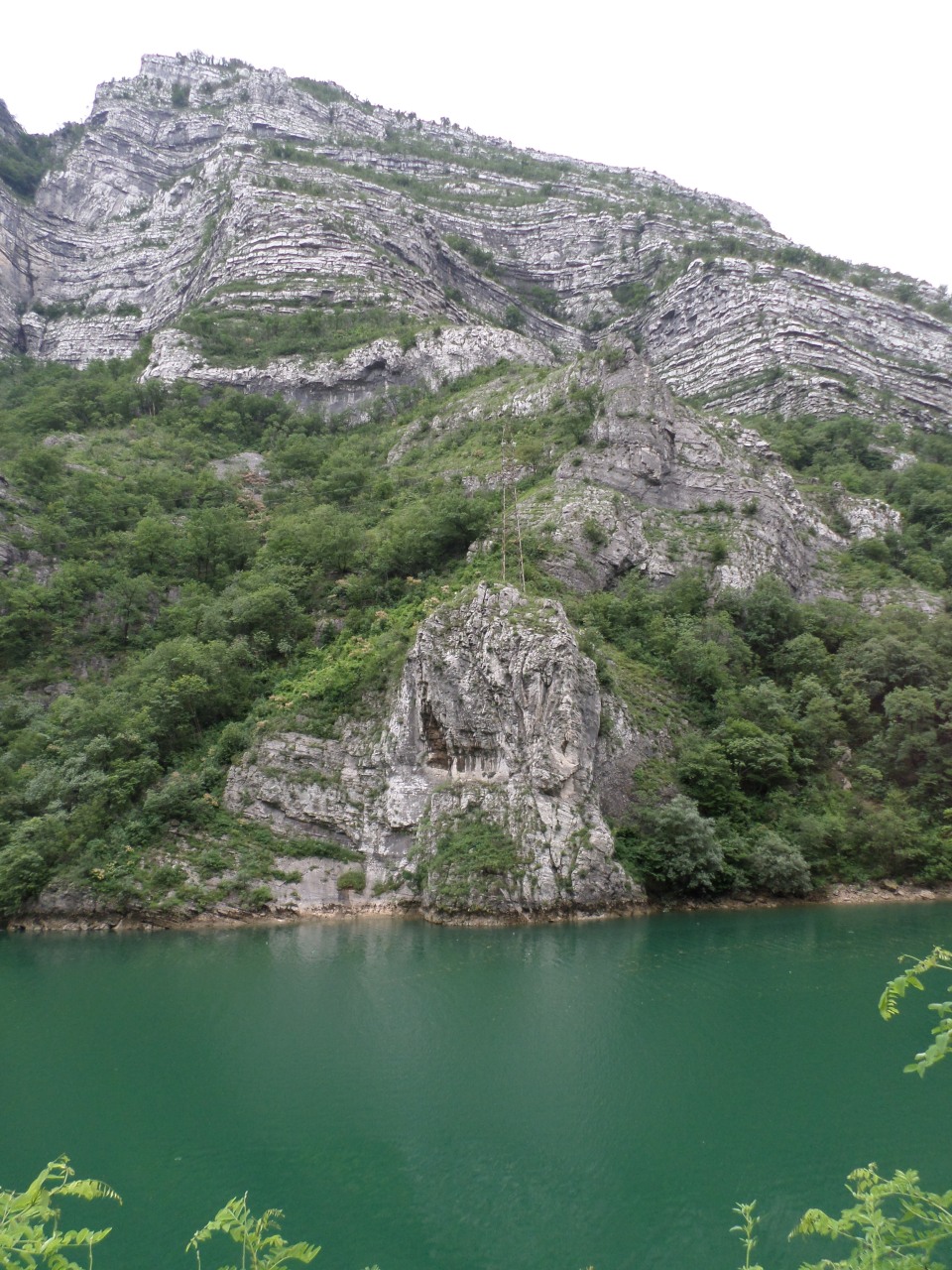
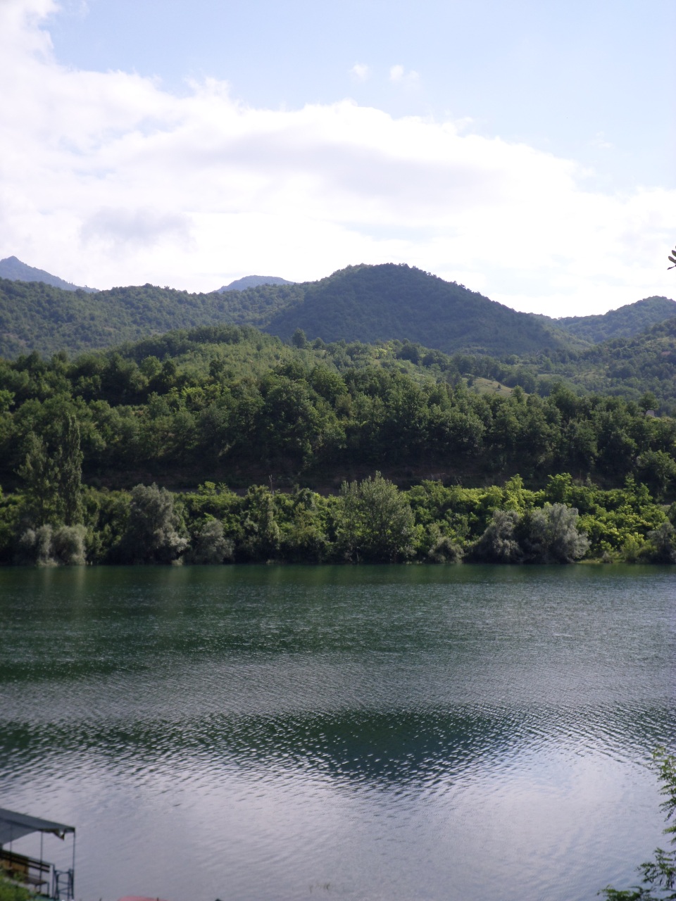
There is only one main road linking Mostar and Sarajevo, with one lane in each direction most of the way (some hills had an overtaking lane). It would be difficult to widen it as it is either squeezed between cliffs and river (or lake) or there are buildings encroaching at the sides. We followed a river for much of the way, and it turned into a lake when we passed a hydro-electric dam. The water was a lovely green and the strata of the surrounding mountains were interestingly tilted. We stopped at a roadside parking area to get a good look.
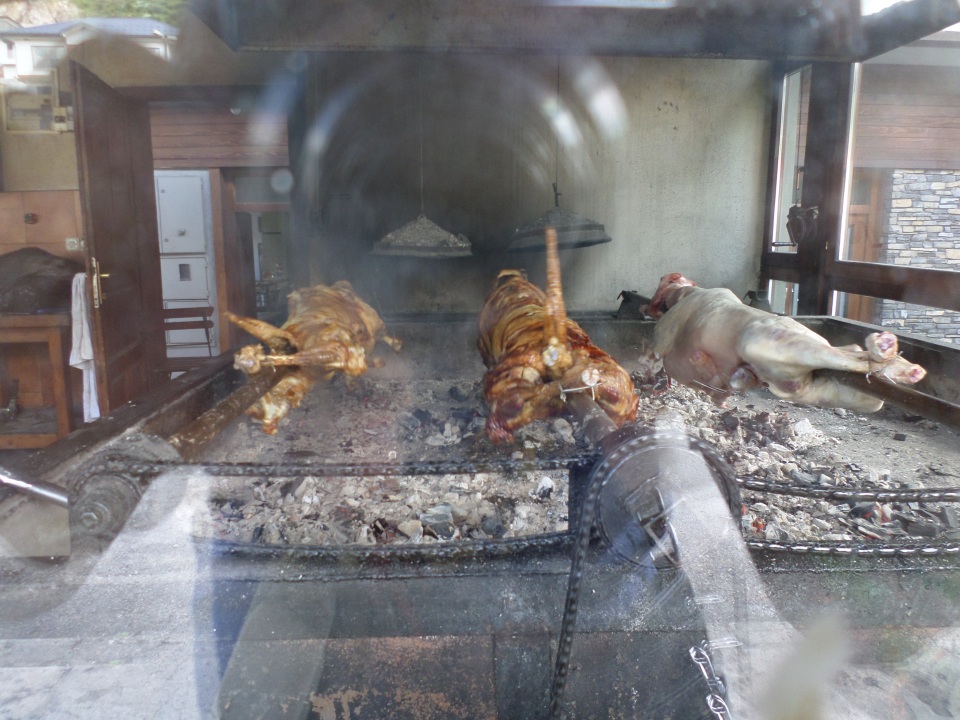
There was a bigger lake that we drove past with lovely reflections, but not easy to capture on film. We stopped again at a roadside restaurant beside the lake, and found the separate kitchen was roasting whole sheep over coals. This is the local delicacy.
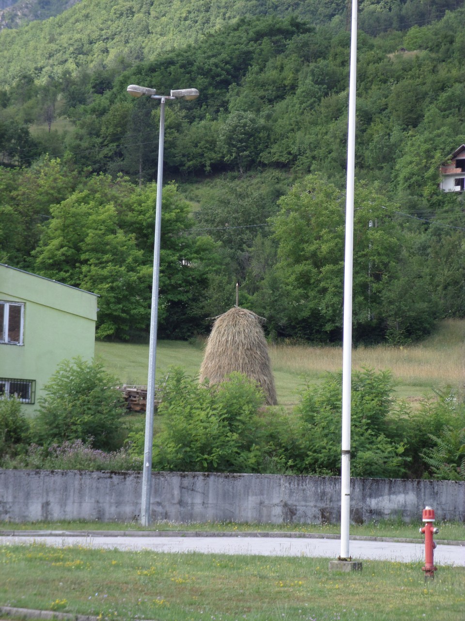
There was also an example of the typical hay stack, across the road.
The vegetation was much lusher and denser, as we progressed inland and up into the hills. Each village we passed had a mosque.
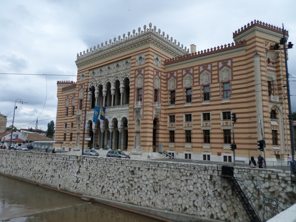
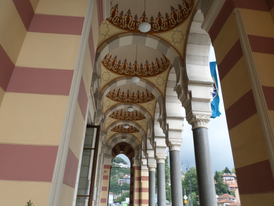
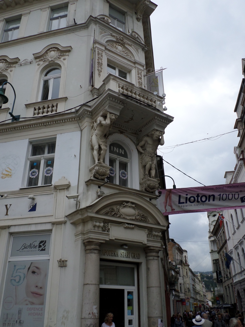
We arrived in Sarajevo and were met by a local guide. We started the walking tour near the Town Hall. This is quite a striking building, originally built under Austro-Hungarian rule, but designed to appeal to more eastern tastes. Unfortunately it was completely destroyed in the last war but has been rebuilt (this was a comment we were to hear frequently).
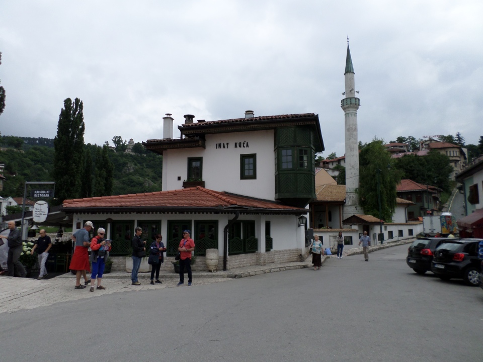
In order to build the Town Hall, several other buildings had to be bought, but one man held out and refused to sell. That is, until asked what it was that he wanted, he said his house had to be rebuilt exactly as it was, but on the other side of the river. So it was, and is known as the ‘inat’ house, ‘inat’ meaning stubbornness, this being typical of Sarojevans, we were told.
The surrounding hills were pointed out to us, overshadowing the city. These hilltops were held by the Serbs in the last war, allowing them to shell the city as they wished. However, they chose to terrorise the citizens, rather than simply destroy everything (although they had a good try at that too).
We were shown the bridges across the river. One was where the first two victims, two young women, of the war in Sarajevo were killed, having been involved in a student march. It is also at the end of a bridge that Duke Franz Ferdinand, heir to the Austro-Hungarian Empire, and his wife Sofia were assassinated by Gavrilo Princip on 28 June, 1914. This was the immediate cause of World War 1, as side-taking escalated among European countries.
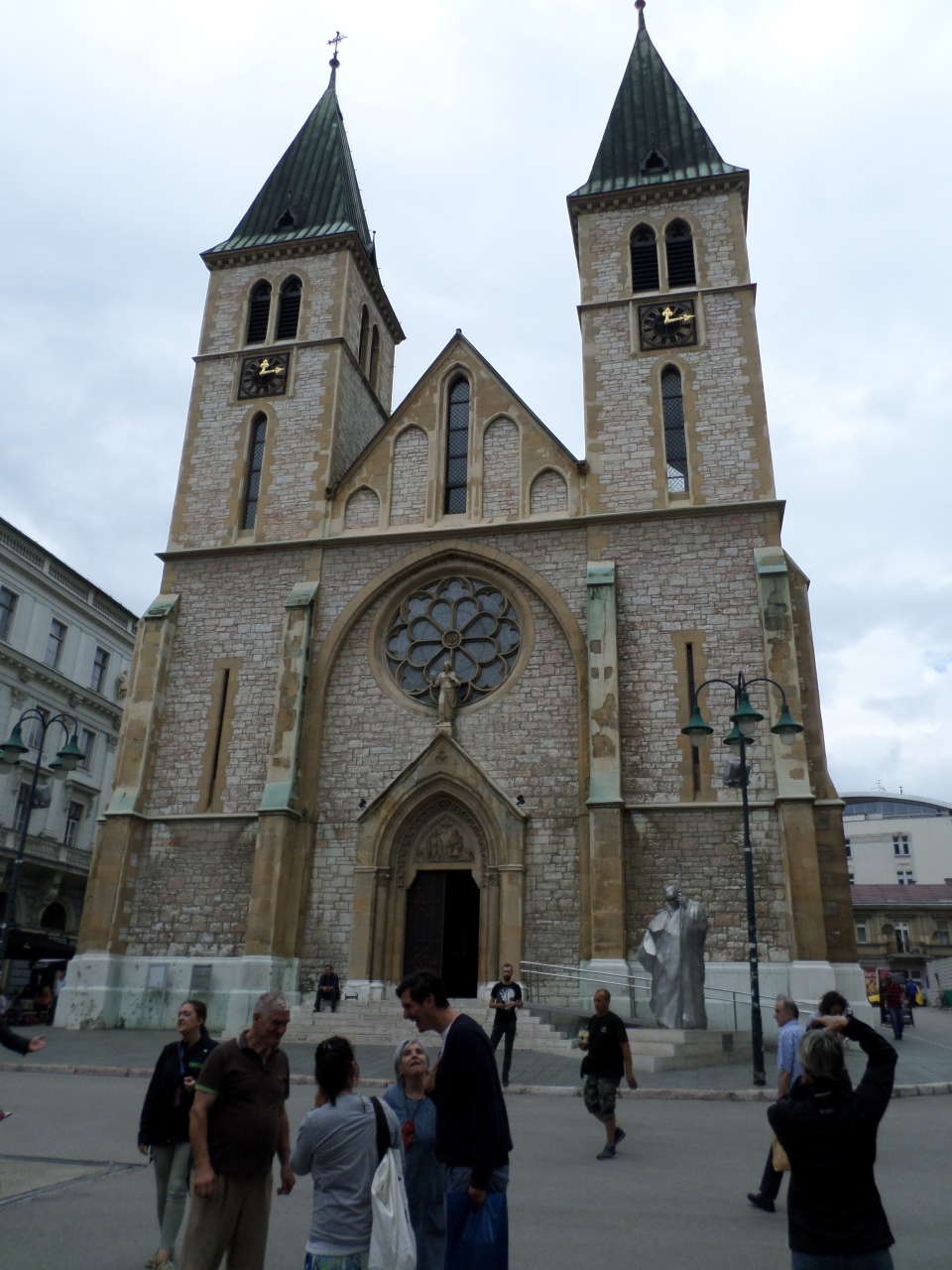
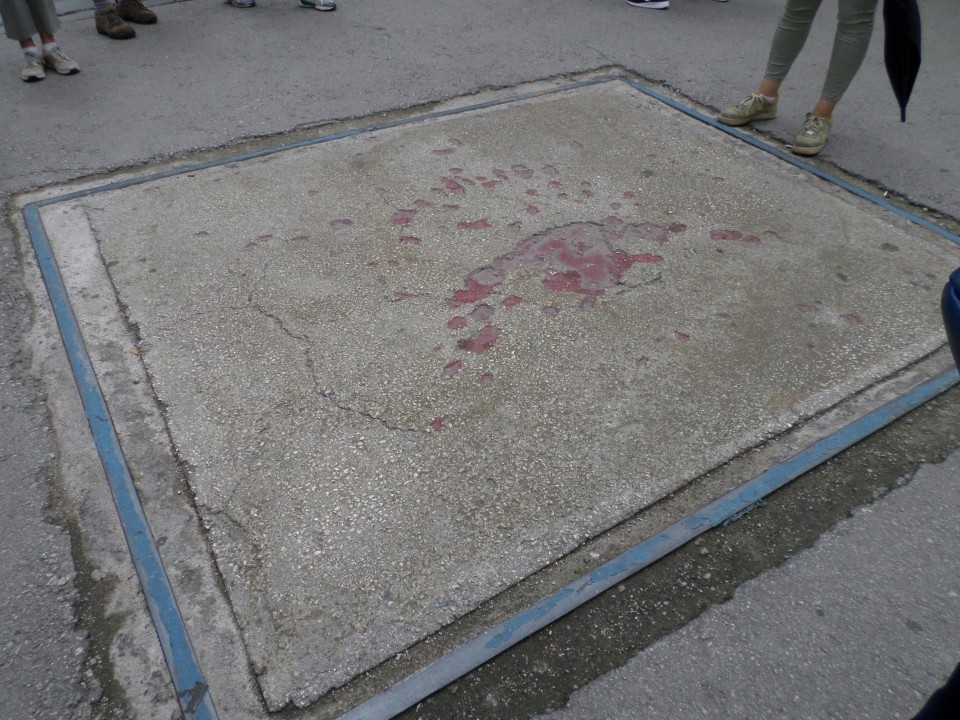
Further along in our walk we came to the Catholic Cathedral (damaged, not destroyed in the last War). There is a statue of Pope John Paul who visited Sarajevo, in front of it. Outside it we saw, and were told about the ‘Rose of Sarajevo’. Everywhere where three or more people were killed by exploding shells, the impact mark has been coloured in red, as a reminder or memorial.
The city also shows much evidence of the period under Austro-Hungarian rule, with baroque architectural features in the ‘west city’.
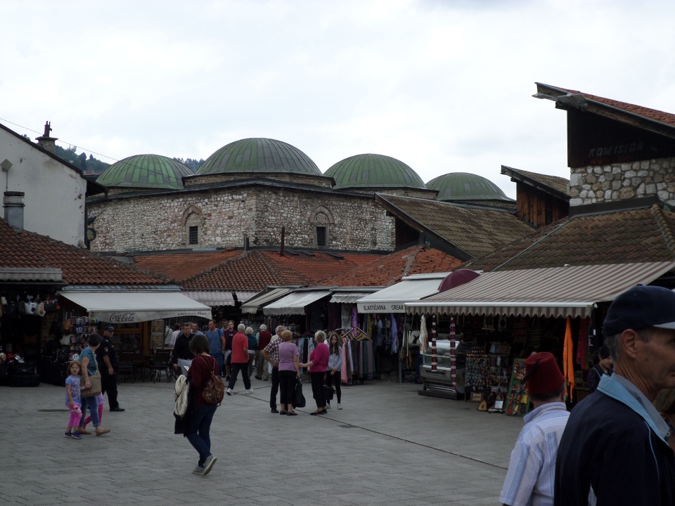
The divide between west and east is marked, with the eastern part having the ruins of an old caravanserai, the bazaar and mosques.
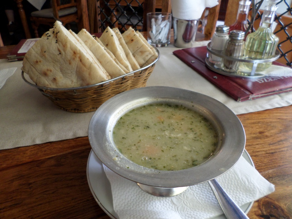
We had some free time for lunch and souvenir hunting. We tried Bey soup, recommended as special to Sarajevo. It is based on chicken broth with various vegetables including okra. It was very good, but we needed a pastry as well to fill up.
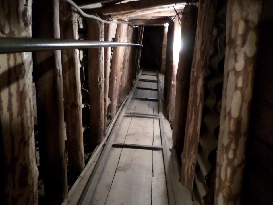
After lunch we were taken to the tunnel that kept the people of Sarajevo going during the three and a half years of the siege. It was dug to get supplies from the free Serbian areas, and a strategic hill or two, on one side of the airport held by the UN (who would not allow passage) to the rest of the city besieged by Serbian forces. The associated museum included video footage of the tunnel in use. Our guide told us about her parents’ and grandparents’ experience of the war, which gave it a very personal slant. There was a list of all the dead at the head of the tunnel. We were able to walk along about 25 metres of the tunnel, that actually stretched for nearly a kilometre under the airport.
Our guide concluded with a positive exhortation that although we should remember the past, we should also see how Sarajevo is now, and recognise the determination of Sarajevo’s people to live together cooperatively.
Then we piled back on the bus and headed back to Mostar.
It was a very long drive back along the same road. I tried to photograph some of the houses along the way. They all seem to have a very blocky, chunky, solid design. Some have painted stucco walls, others are just bare blocks. Some have reo sticking up out of flat roofs, as if a further floor was expected but not completed. In larger towns and outskirts of the cities were large blocks of apartments, from the Yugoslav era, also functional rather than aesthetic!
Back at the Mostar hotel about 7:30, we decided to eat in and get a good nights’ sleep.
Hvar to Mostar
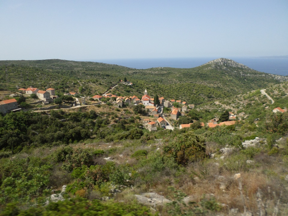
Tuesday(13 June, 2018) was the transfer from Hvar to Mostar in Bosnia. We started off along the main road between Hvar town and Stari Grad, but then diverged to travel the length of the island, on a rather narrower road. We drove along, passing vineyards and olive groves, lavender fields and stone-walled plots being taken over by scrubby Mediterranean re-growth. Occasionally we would see a small village, or a cluster of houses, some of which appeared to be abandoned, or a church on a distant hilltop. There were also picturesque views down into secluded coves, or across dramatic valleys.
As we progressed along the island, the road became narrower, to the extent that when we met an oncoming vehicle of any great size, our bus had to back up to the nearest passing spot. Our driver was clearly expert at this, to our applause each time it was successfully negotiated. We also had to get round some extremely tight curves, but these were also manoeuvred round well, although the steep drops off the road were a little concerning, especially when yet another truck appeared, coming our way.
Arriving at Sucuraj at the end of the island, we had to wait a little for the ferry to Drevenik to come in but were far enough forward in the queue to make it aboard. It was not a long crossing, about 20 minutes, and we were chased by a thunderstorm. Here we had ninety minutes for a lunch break, so walked to find a reasonable cafe and settled in just before the rain started. We ordered salad, but it took ages to appear. Mine was lots of lettuce and cabbage, three slices of tomato and three of cucumber and lots of grilled chicken. I just had time to eat most of it before we had to leave to get back on the bus – we were in such a hurry that no-one left a tip – which I felt guilty about afterwards.
Back on the road, we travelled along beside the sea for a bit, then cut over the hills and alongside a string of lakes that I think I heard Sibila say were actually below sea level. Over another hill, and we came to Ploče on the Naritsa river delta and source of the local delicacy – frogs and eels.
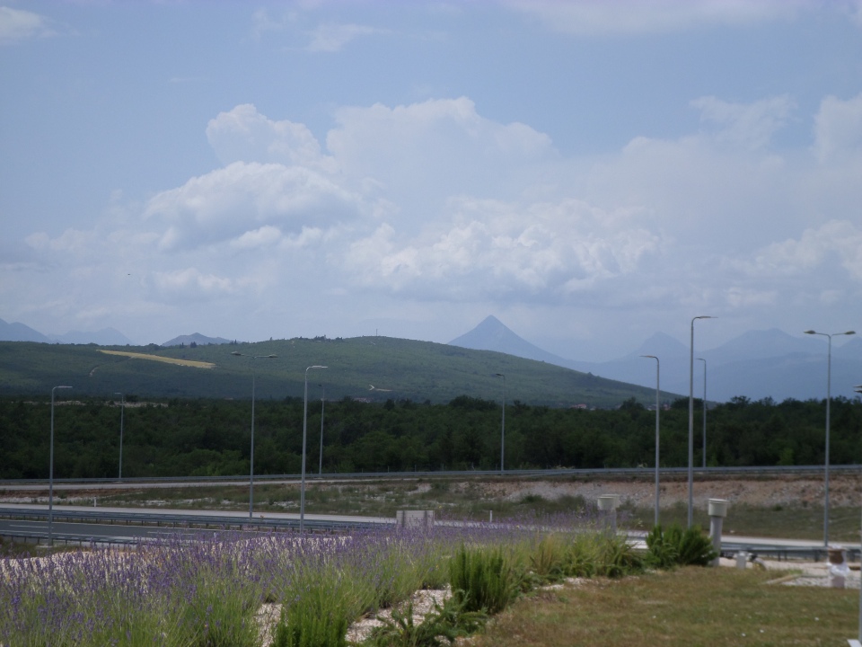
Here we turned left and joined a highway heading up into the hills and going through a few tunnels. The landscape began to look more lush and less rocky. Soon we hit the border with Bosnia. It actually did not take long, we got another stamp in the passport, and were off again. We stopped again shortly after the border crossing at a highway service centre for refreshment. I was intrigued by a pyramidal mountain in the distance.
Travelling on, we drove through Medjugorje – the location where six children saw visions of the Virgin Mary while tending their goats, some decades ago. I do remember the international attention it engendered, and apparently many pilgrims still come (mostly, obviously, from Catholic countries). A little later we went through a village (Pojeta?) with what Sibila described as a tourist trap market (so we did not stop, unlike several other buses that we passed), but we did have our first view of a village mosque.
Finally we descended some hills into Mostar. A big cross on a hilltop was pointed out to us, erected by local Christians. The story goes that a journalist asked a local Muslim what he thought of it, and his considered reply was ‘It is a big plus for democracy in Mostar’.
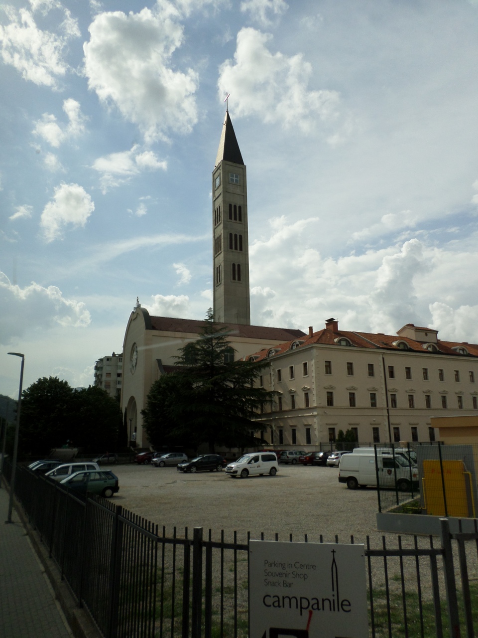
On arrival we were taken on a walking tour of Mostar, starting from the Franciscan Church/Monastery. This has a fairly recently constructed (2000), very tall, bell tower. To me it said ‘Our bell tower is taller than your minaret’. The interior of the Church is still being re-constructed after the 1990s war. Called ‘the homeland war’ by an earlier guide, here the guide just referred to ‘the last war’.
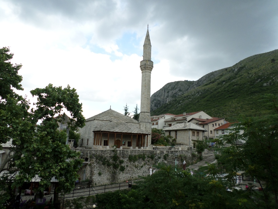
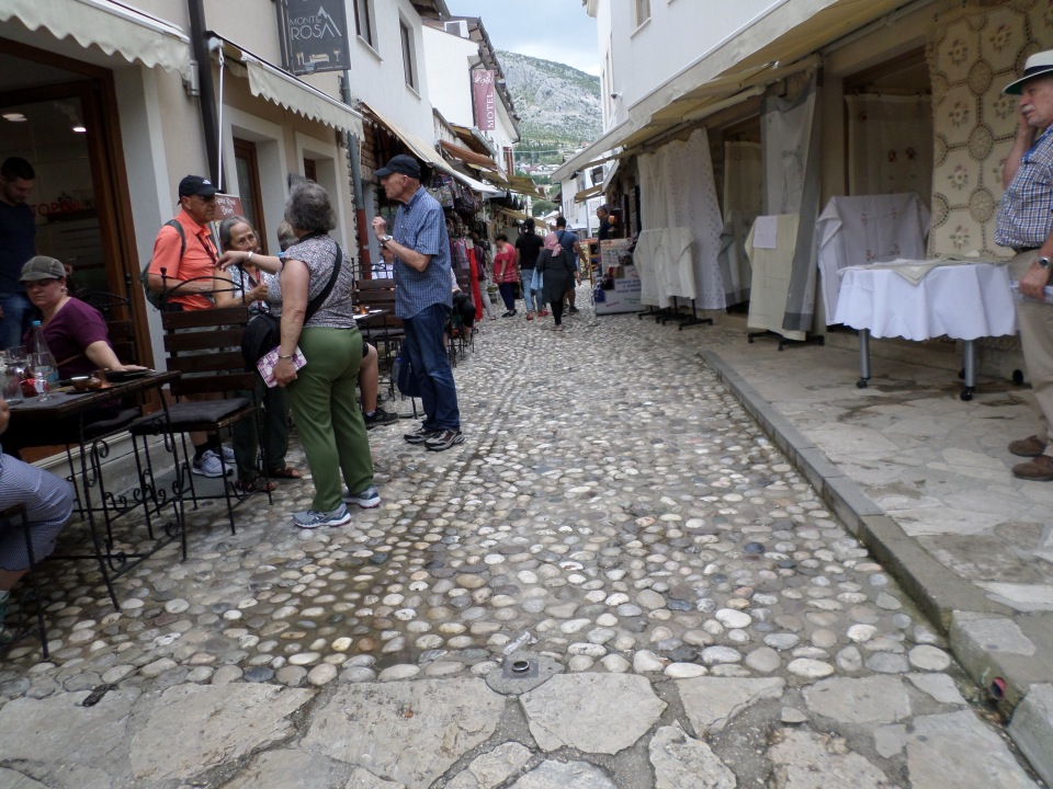
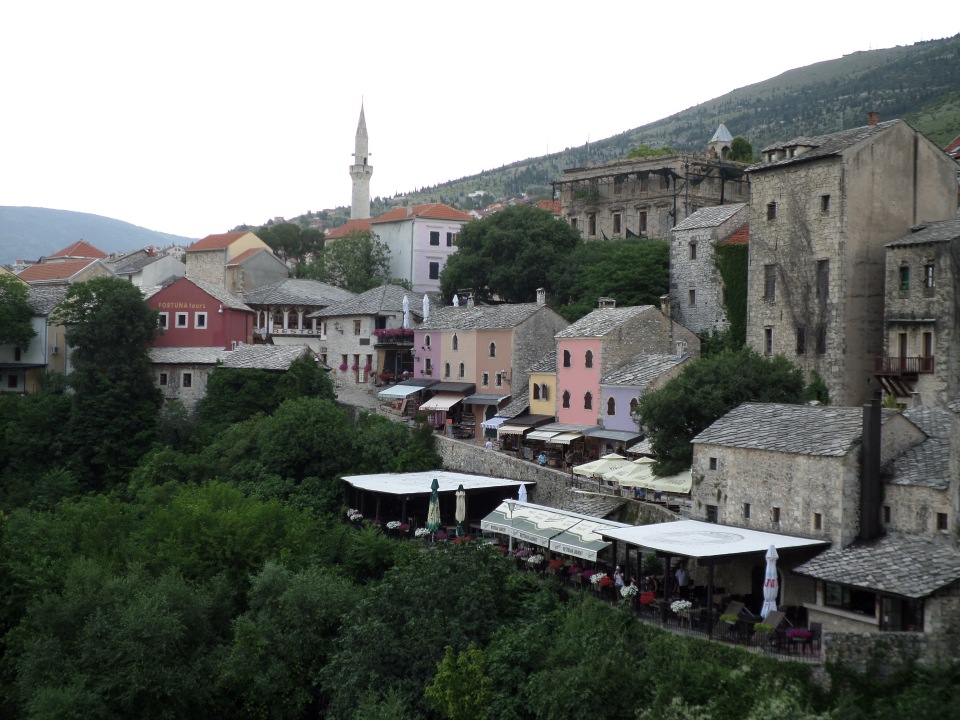
We were led towards the Old Town past the vacant site of a proposed Synagogue. The guide said that there are only about 50 Jews left in the town, and later also said that they had just regained control over a building that used to house a Synagogue, so perhaps the new one will not go ahead. We had already seen many pock-marked buildings and quite a few that were burnt out shells. Then we got to the Old Town, and walked along a cobbled street between souvenir shops and cafes. Several mosques and an Orthodox Cathedral (under reconstruction) were pointed out to us, and a bath house (now a museum).
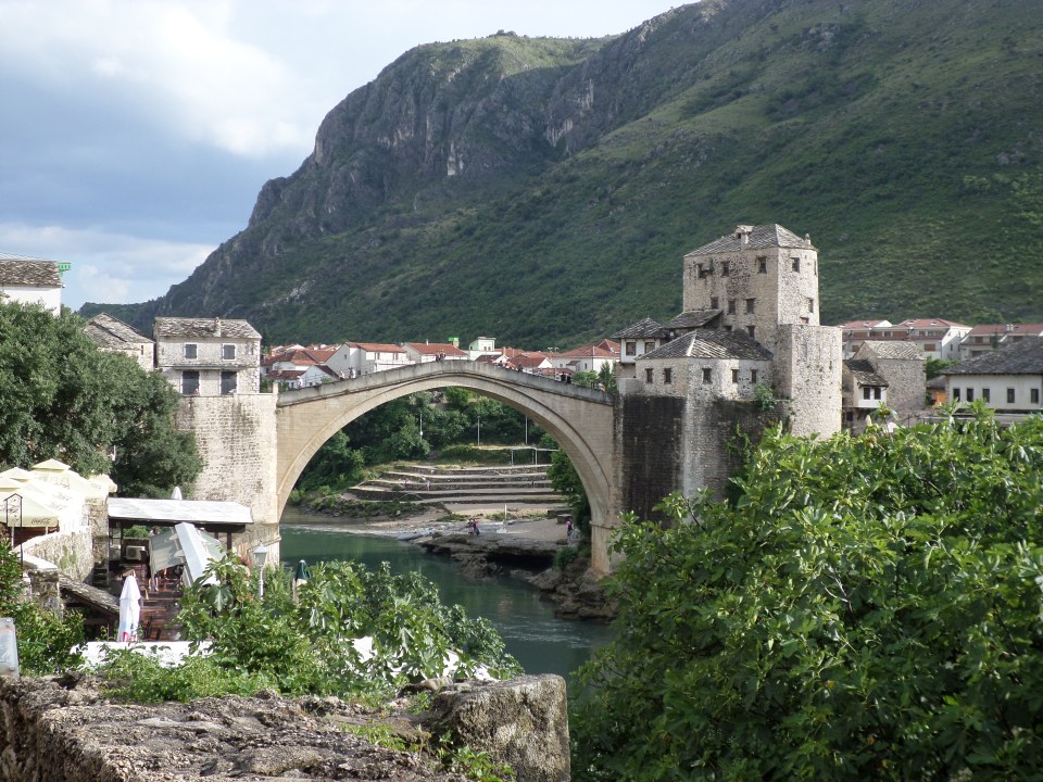
We then found ourselves at the famous Mostar arched bridge. From there we could look to the other side of the river, and more Old Town. The surface of the bridge was ridged to improve the surface for horses to pass over it. Once we crossed the bridge and looked back, we got a better view of it.
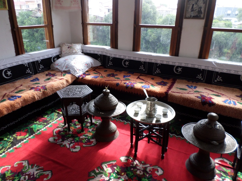
We visited a Turkish House, still furnished as it was left by the owner when he died about ten years ago, at great age. It was set up as a typical Moslem home, with an outer and an inner courtyard with a fountain, lower room to receive guests and a steep stair up to a women’s room (open on one side like a deep veranda) and a man’s room, a sitting room (with four walls)opening off it. All had rich carpets and eastern style furnishing, sofas and wooden tables. We were also shown the wife’s bedroom (I assume the husband slept elsewhere…). The rain poured down while we were visiting, but stopped as we left.
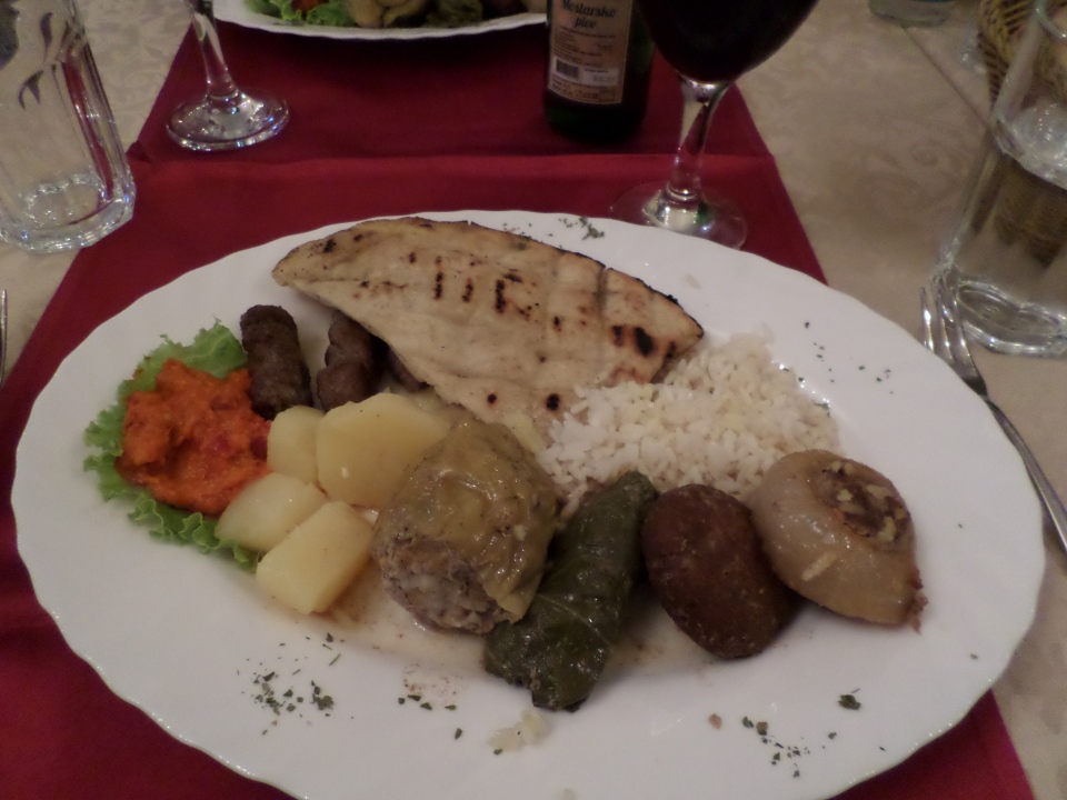
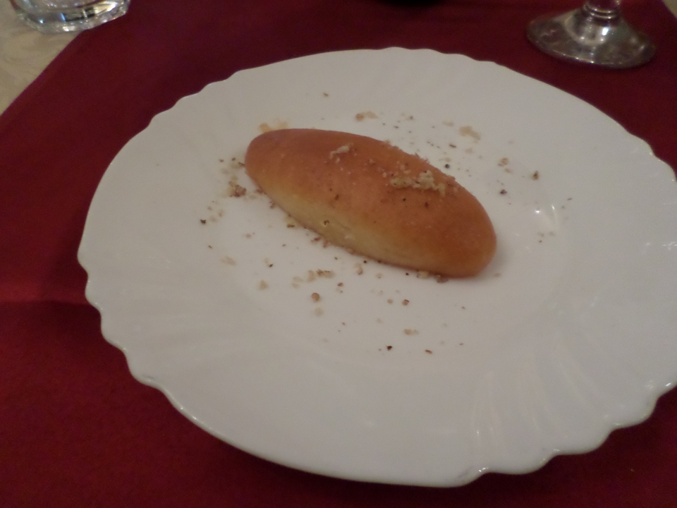
We were then taken back through the Old Town in which was the restaurant where we were treated to a feast of typical Bosnian food. A salad to start, then a piece of bread and vegetables stuffed with mince and rice, and sausages (that actually have another name that I have forgotten). Dessert was baklava, but not like that which I am used to, not nuts and not filo pastry, but a more doughy pastry and still drenched in honey! This was served with a large glass of wine.
Back to the hotel to sleep it off.
Hvar Island Tour
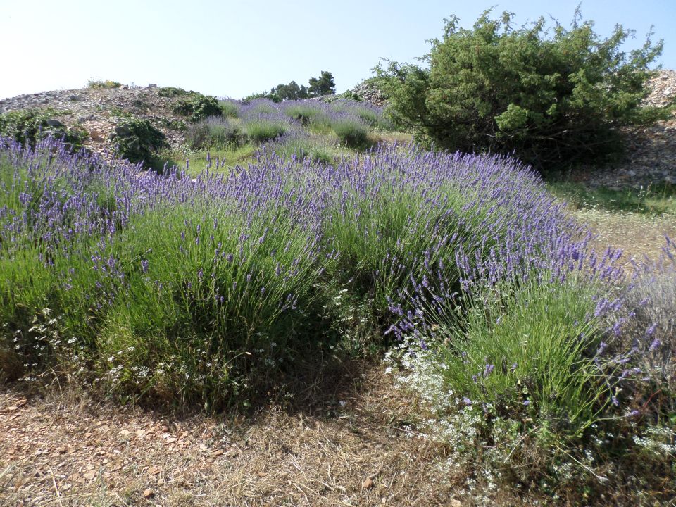
It was Tuesday 12 June, 2018. We climbed aboard our coach for a day out on Hvar to look at some of the sights. We drove across the spine of the island, rather than the coast road and tunnel that we used when arriving on Hvar. The road today took us up into the highlands and we stopped to admire the lavender bushes, in full bloom and giving a blueish-purple tinge to the landscape.. Hvar is known for its lavender crop. Lavender was commercialised on the island during the Yugoslav period, and was actually discouraged by the authorities as it was creating disparity of income!
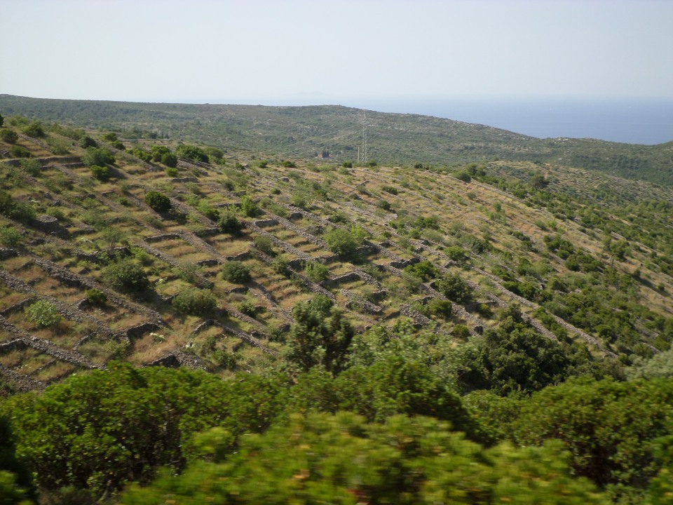
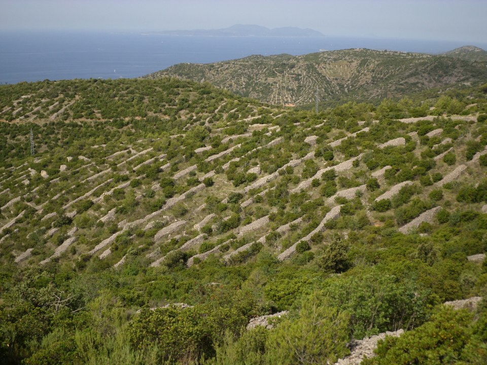
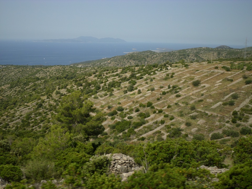
Hvar is also known for its network of dry-stone walls – as are several other places in Croatia but they seem more extensive in Hvar. Basically, if one wanted to grow anything, the rocks and stones had to be removed from the land. Thus, they were stacked up in walls round small plots of land, up and down slopes – which incidentally (or possibly purposefully) deflected run-off from rain, thus preventing the development of gullies and retaining the top-soil. In the past these small plots were cultivated but at this point they are not. It is far easier to get a job in the tourist industry, even if not for the full year. A local signboard indicated that these were mostly constructed in the nineteenth century for intensive wine production, and were used to grow lavender in the 20th century (I think a blight got to the vines), and now are becoming overgrown.
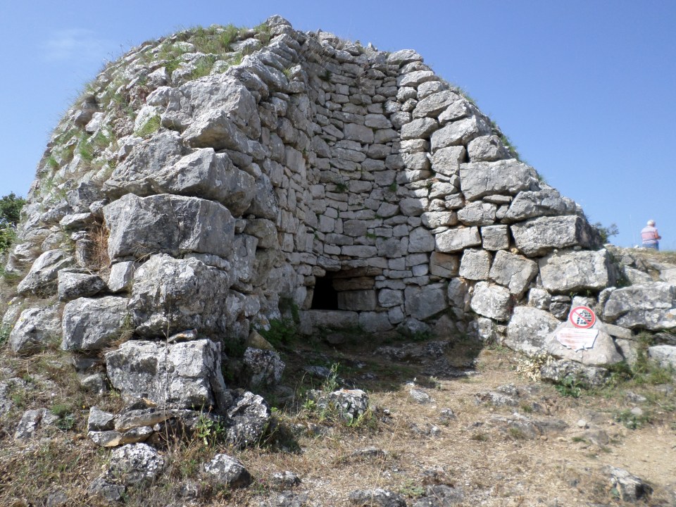
Small stone round huts were also to be seen, for tool storage or overnight stays.
Villages clinging to the upper slopes were not easily reached by pirates, and were more defensible. However they are becoming de-populated.
We stopped beside the road a bit further along to look at a lime-kiln. This was built of blocks of limestone but the idea was to melt stones inside to produce lime-wash or white-wash. As it happened, this kiln was built but never used, because World War 1 broke out. Incidentally, we could see the sea on both sides of the island from here. Had we the time we could have walked up the mountain to the Church of St Nicholas.
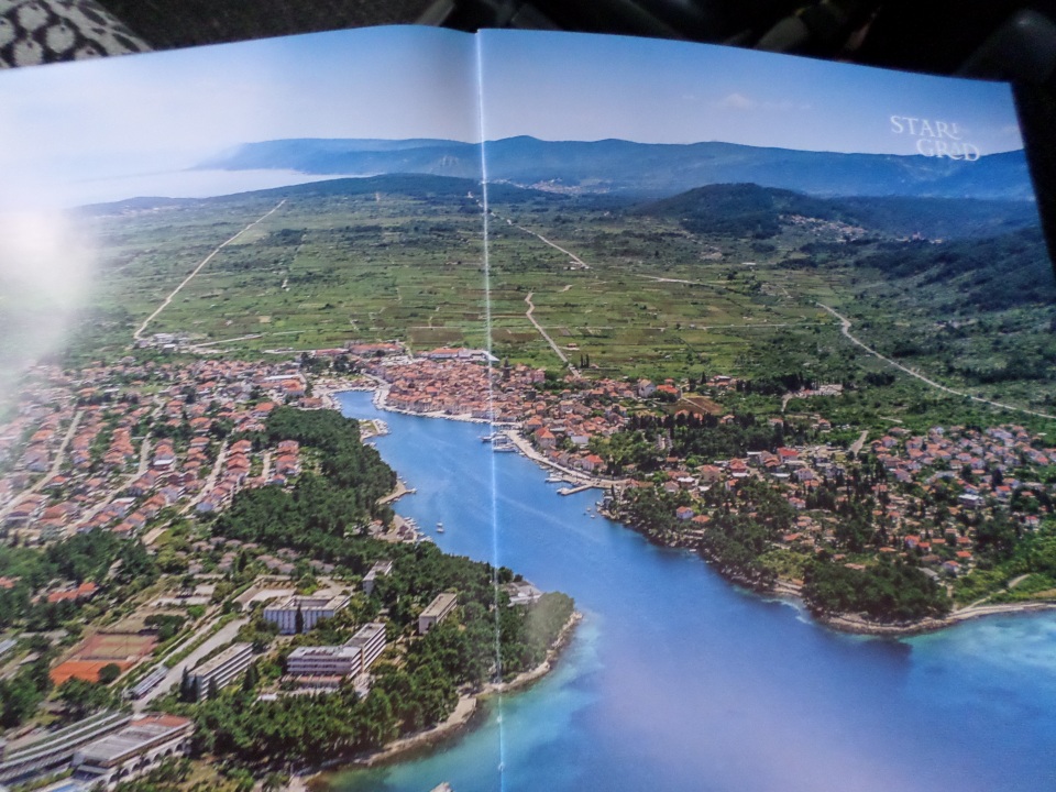
We drove on down the mountain and across the Stari Grad plain. This is World Heritage Listed as it preserves the field divisions assigned when the colony was first set up by Greek settlers from Pharos in the fourth century BC. It was practically impossible to see this from the road, and even the photograph in a magazine that Sibila passed round did not show the division very clearly.
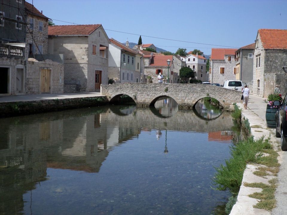
We stopped for a break at the village of Vrboska, set on a river on the opposite side of the Stari Grad plain. There were a couple of bridges, and several cafes!
Our next stop was at a wine-makers establishment, where we were taken down to their tasting room that was built along the lines of a Roman dining room of triclinium, the main difference being that it was set up with a long table, not reclining couches. However, it did have a vaulted roof and rounded niches along one side. Our wine tasting was paired with a tasting plate of cheeses and other nibbles, like anchovy and proscutto.
Following this, we proceeded to Jelsa for a gelato break. Sibila also took us to see (the outside of) a small church tucked away in a back street. The gelato was very welcome as the day was very hot.
We got back to the resort near Hvar town in the early afternoon. We spent most of the rest of the afternoon in the swimming pool, where I indulged my inner child with use of the water slide. Dinner was a sandwich collected from the bakery in the old town.
Free time in Hvar
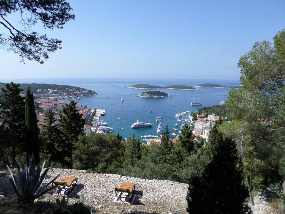
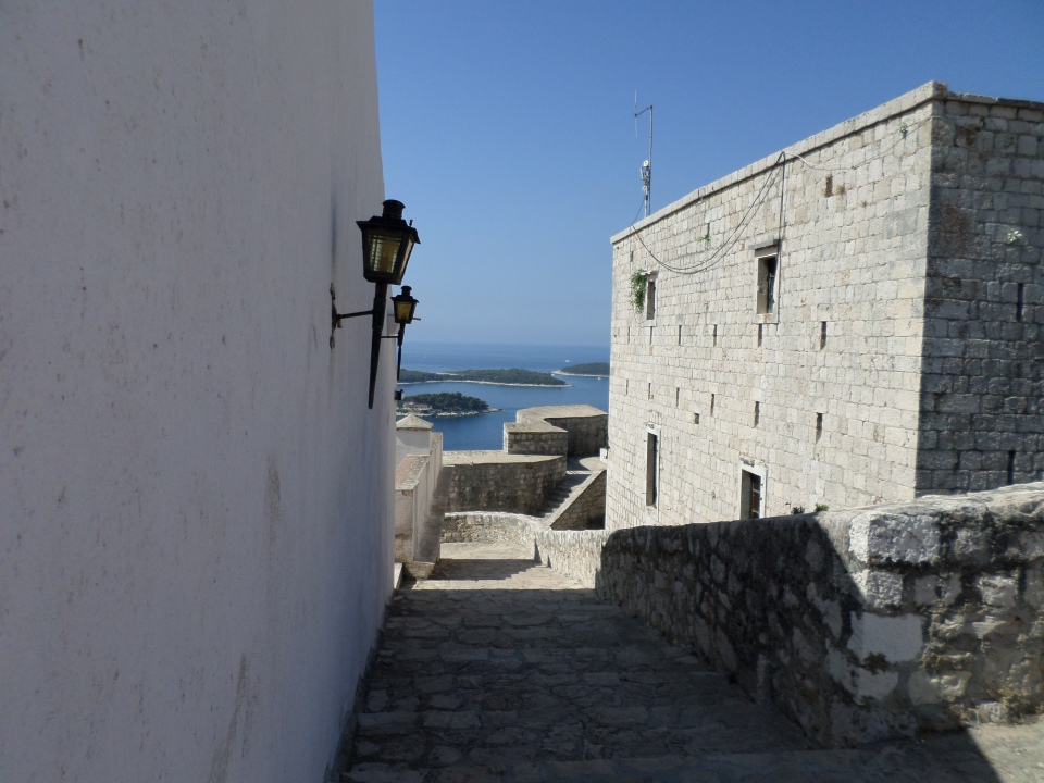
Up at a reasonable time (on Monday 11 June, 2018) and partook of the excellent hotel buffet breakfast. We decided to walk up to the Fortress before the heat of the day, and set off at 9 am (probably a little late, but hey, we are on holiday). The Fortress is the Forteca Spanjola so called probably because some Spanish military engineers were involved in one phase of its construction. The promenade was an easy walk, but then we started to climb, lots of steps up to the top of the town, and then a sloping zig-zag path through what was established as a Mediterranean Herb Garden but now appears to be mostly pines and agave plants. At one corner, the construction of the wall was interesting, as it appeared to have courses of stones that paralleled the slope, rather than horizontal courses, at least on the lower part. Perhaps that is why the military engineers were called in.
Rather worn and hot, we eventually got to the Fortress. The view was magnificent, but the actual town was invisible below the trees.
Information from various sources: The first fort was probably first century BC, there was a Byzantine citadel in the 6th century AD, construction of the present fort began in 1282 (when under Venetian rule). It was largely completed by 1551 (the date above the main gate). It saved the townsfolk from an attack by Ottoman forces in 1571, but unfortunately a lightning bolt hit the gunpowder store at 3:30 am on 9th August, 1579. The explosion destroyed part of the fortress and part of the town beneath it. Repairs and adaptations went on for the next few centuries, with the Austrians building new barracks and raising the battlements. However, when it lost strategic importance in the second half of the 19th century, it was, in local terms, “left for the fairies to dance in at night”.
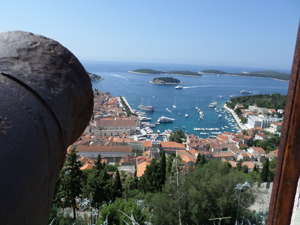
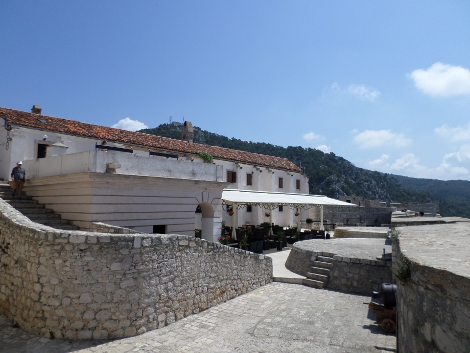
It was very hot by the time we arrived, but there is a cafe in the fortress, which provided cooling drinks. We headed down again after a while, and encouraged those still on the way up.
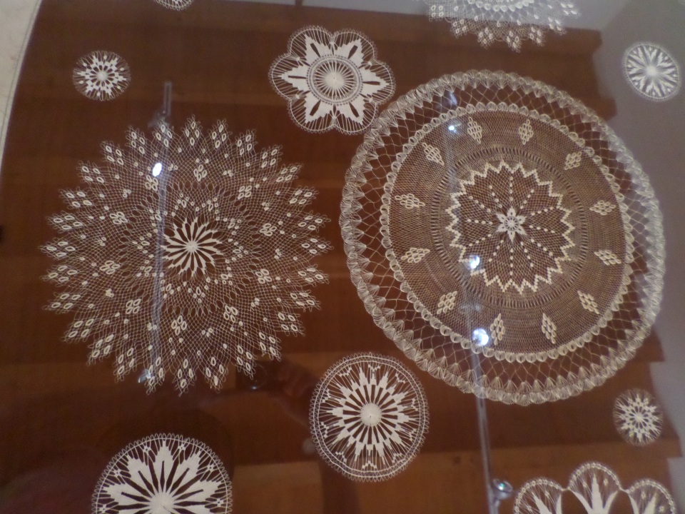
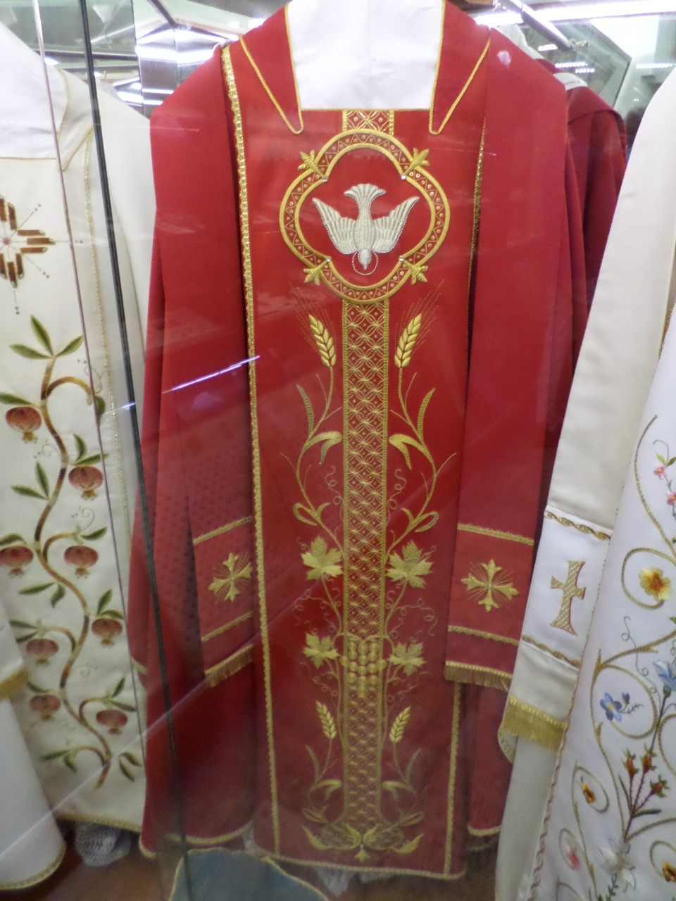
Just off the staircase on the route, is the Benedictine Abbey. We went in and admired the beautiful lace and embroidery produced by the nuns. There are only nine of them left, and all are very old. I don’t think there are any new recruits.
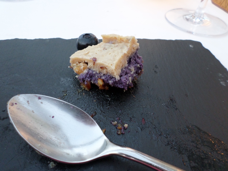
Lunch from the bakery was eaten in the shade along the promenade. In the afternoon, we went for a swim in the pool, and for me a slide down the water slide. Later, we walked into the town and found a restaurant with a rooftop terrace, which caught the evening breeze. We had a vegetarian entree each, so that we could have dessert. I had a lavender and blueberry cake. It was amazing, and literally tasted how lavender smells, I was not sure if I was eating or inhaling it. I had nearly finished before remembering to record it for posterity.
Travel to Hvar
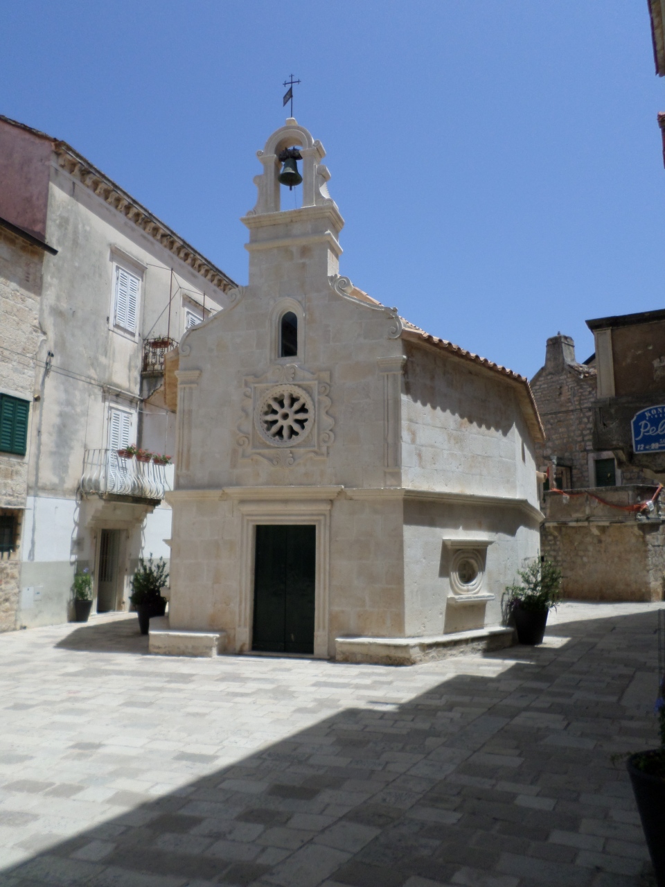
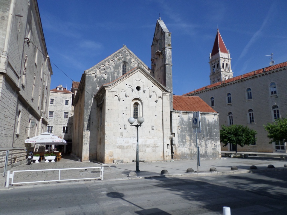
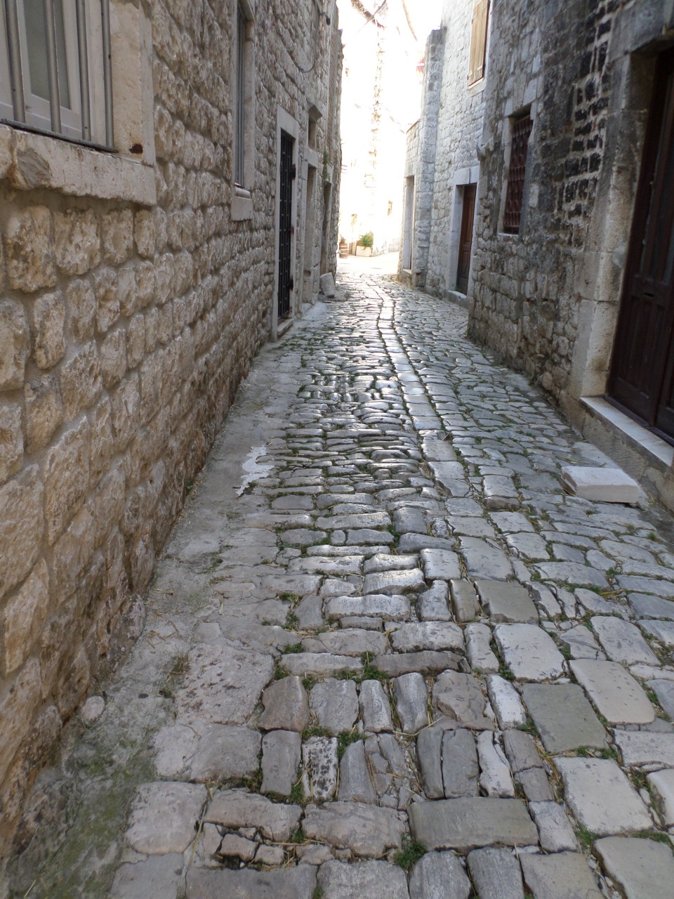
On Sunday 10th June we had some time in Trogir where we did a leisurely walk about to take photos of things that we missed on previous visits, or that we thought we could get better photos of. This included the small thirteenth century church of St John the Baptist. I also took a photo to show the uneven cobbles of the oldest alleyways.
We joined the bus for the ride into Split, where our driver queued up for the ferry and we had some free time. First activity was to speed walk up the Marjan Hill to the terrace bar overlooking the city. The view was worth it, but did not photograph well due to trees and haze. We also took the time to go inside the Cathedral, which we had not yet managed to do. That was interesting. The main Nave is originally Diocletian’s mausoleum and is polygonal rather than rectangular. The altar (very grand) is in the space knocked out of the east wall with a Chancel behind it (added to the Mausoleum later) with seats for the clergy and some frescoes.
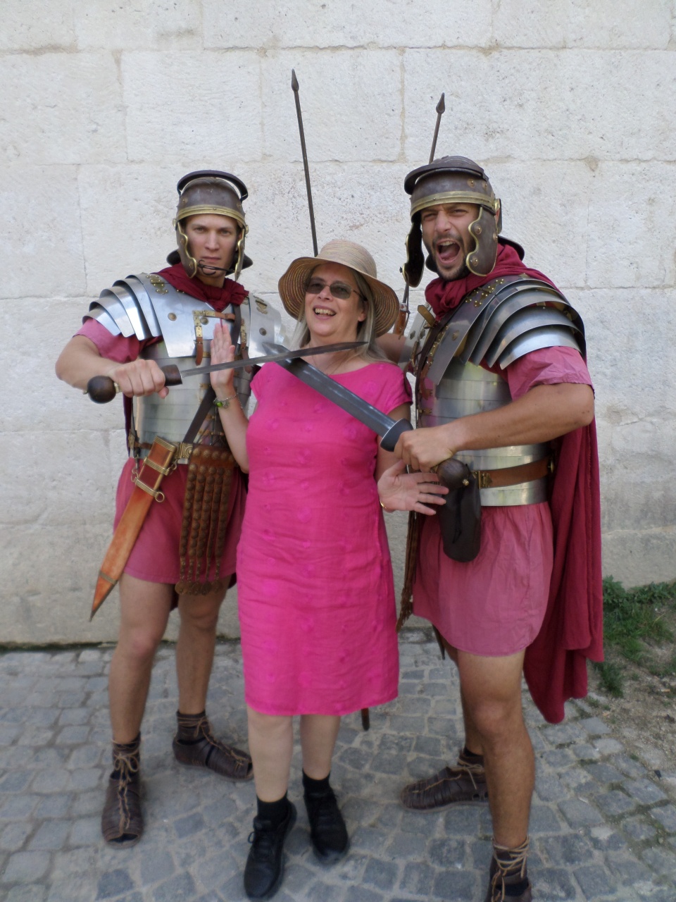
Time in Split also necessitated another trip to visit Gregory of Nin and rub his toe: either one’s wish is granted or one returns to Split. So having returned, I felt I had to renew my wish. Then I had a bit of fun with some Roman soldiers. Although they are paid to stand ready for photos, they also expect a substantial tip.
The ferry to Stari Grad on Hvar island took an hour or so, and was not eventful. We landed at Stari Grad, the main town, but shortly before we landed Sibila got us all onto the bus which is, strictly speaking, not allowed. Her motive was apparent as we drove off the ferry: another tour bus that had got onto the ferry before us needed to pull over and board its passengers, so we got onto the road first instead of following them! We had to drive across the island, so got a look at vineyards and olive groves, and land that had returned to low scrub. We also saw lots of rocks and stones.
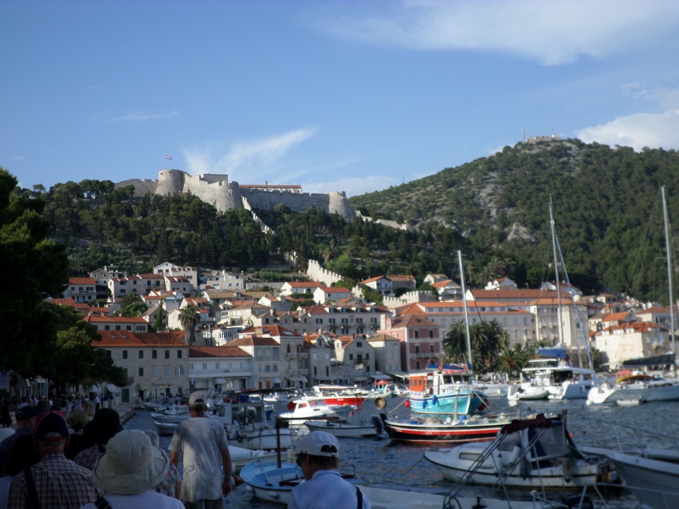
Driving into Hvar gave us a distant view of the fortress above the town. We had to drive round behind the hill in order to get to the resort, because of the Fortress and its defensive walls that enclosed the town. After check-in and freshening up, we went for a walk along the promenade to Hvar town itself, discovering on the way that the resort has a pool with a waterslide as well as a shingle beach.
Hvar town has spread out from its original cluster at the base of the hill under the fortress, and has many working boats, and visiting yachts.
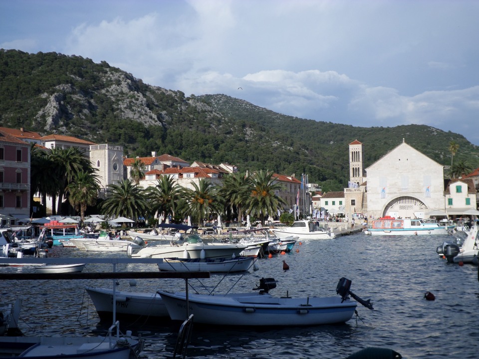
Sibila gave us an orientation talk noting the Arsenal, where boats were built and repaired- one of the biggest in the region but now used as a theatre, in fact the upper floor has been a theatre since the seventeenth century! The Cathedral was pointed out and directions given to the Abbey where Benedictine Nuns make very fine lace out of agave fibre. She also gave us important information like the location of the best bakery.
We wandered about then returned to the hotel for a buffet dinner (included in our tour) which was excellent, but I ate too much!
Visit to Krka National Park and Sibenik
We were up early on Saturday, the 9th of June, for an eight am departure to go to the Krka National Park. There had been a thunderstorm overnight and some rain as we drove along, resulting in a lovely rainbow.
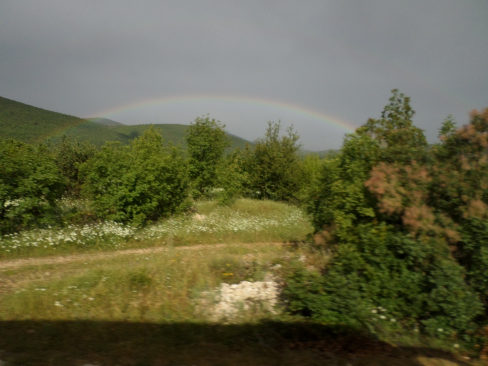
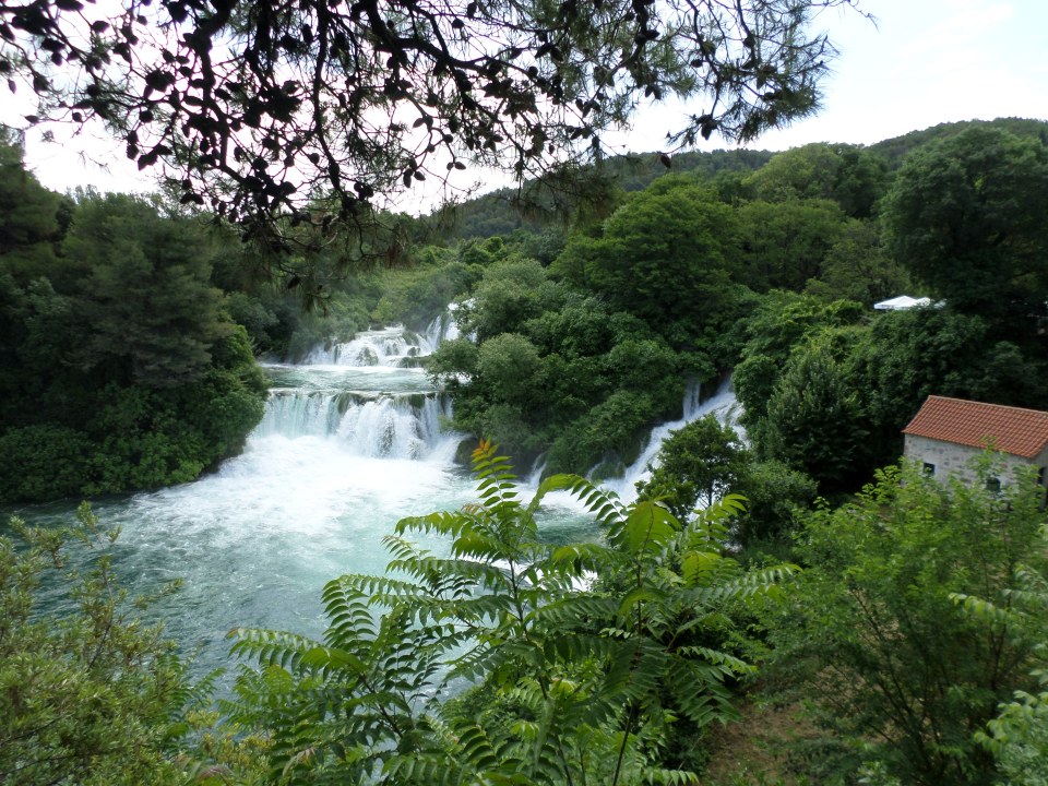
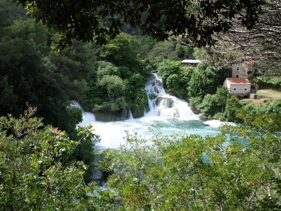
Although the clouds looked fairly menacing, they dissipated as we drove. Our first glimpse of the lake was with scattered clouds, and from a rather serpentine descent! Because of the recent rain, the river was running high and fast, and the waterfalls were very impressive, and loud. A short walk from leaving our bus, we found the first falls, near a group of stone buildings.
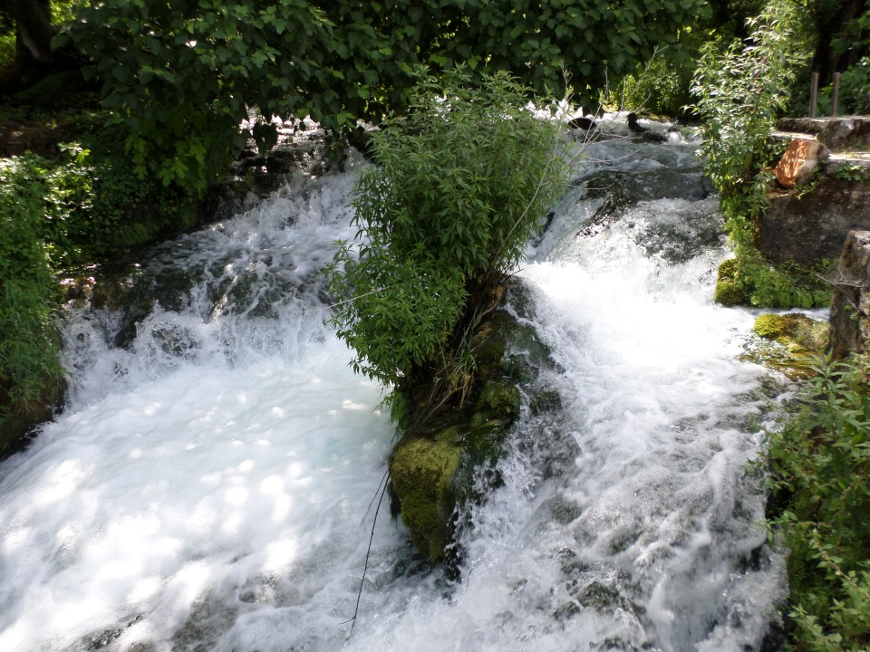
Among these buildings was a watermill, with several grinding stones available to be powered by the water, although only one was in operation and it was turning very quickly. There was also a fulling mill (for processing cloth). The noise and power of the water was amazing.
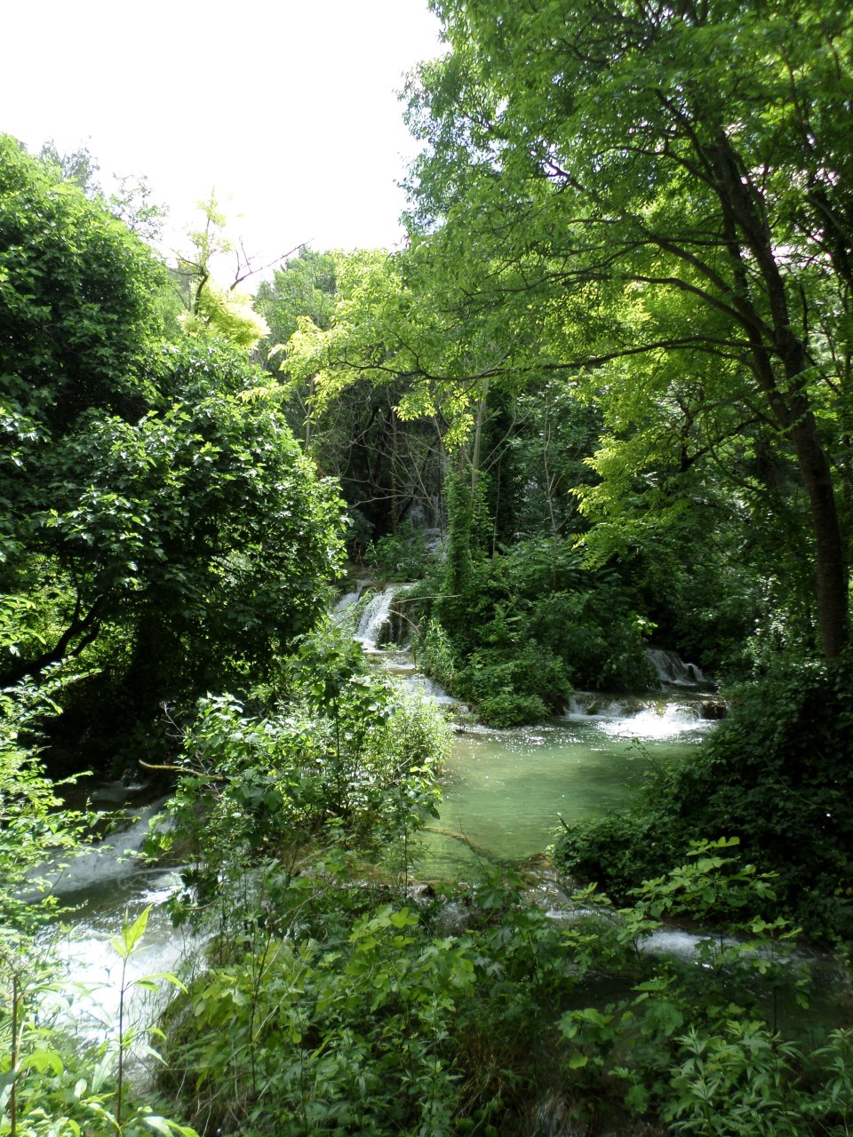
We walked along winding paths between the various falls and pools. It appears that the process of forming the falls was similar to that in Plitvice National Park, but here the river fell into pools rather than big lakes, the scale was smaller although some of the waterfalls were fairly high.
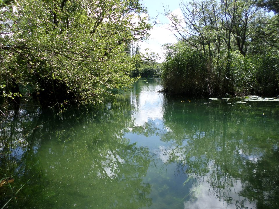
There were congregations of fish in some of the quieter areas of the river. Perhaps they were avoiding the fast rushing currents in the main stream. Where the water formed pools, there were lovely reflections and the water was very clear.
We reached an elevated area, up above the place we first entered, so had a view back to those falls from above. A bit further round, we could see the original hydro-electric station.
The streams entering the main river were spreading out a bit more than usual, and we were glad of the elevated pathway. The place was so lush and green, and full of noisy water!
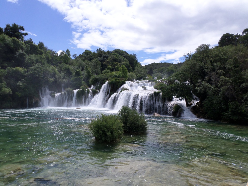
The final falls were not huge, but thunderously impressive.
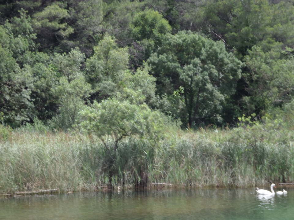
We finished our trip to the Park with a boat ride along the Krka River to Stračin. The river was a beautiful green, and fringed by reed beds. On the way we saw several swans with their cygnets, already turning white.
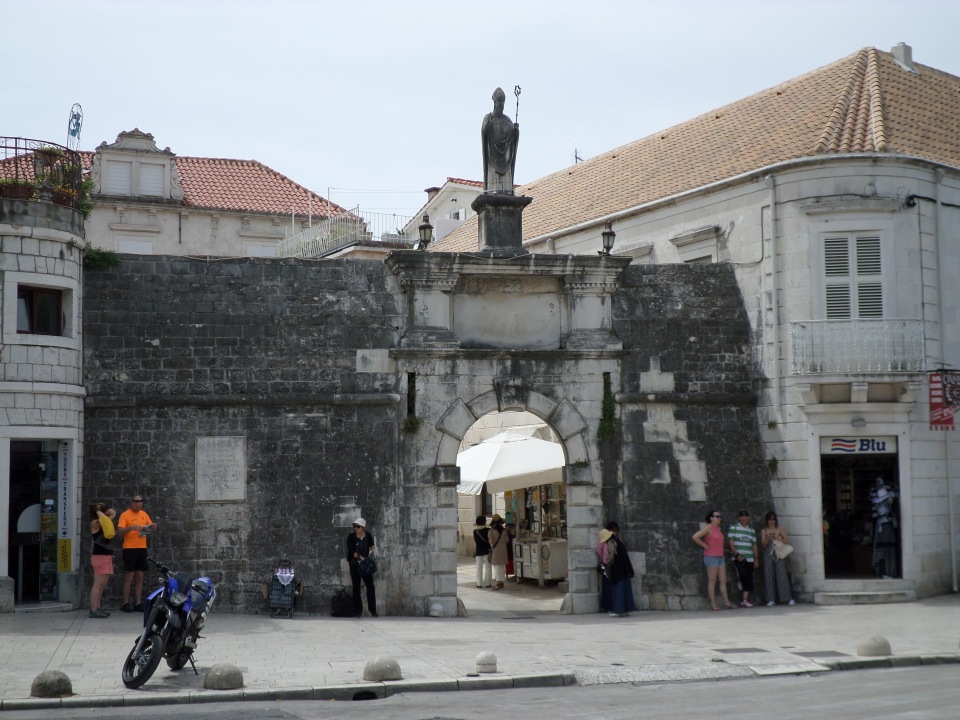
We passed through a gorge in the limestone, to emerge into the basin where Stračin lay. There, we had lunch and explored the small town. There is a fortress on the hill above, but looking at the path up to it and given the temperature, we decided against the ascent. The town was one of contrasts, there were wide streets and narrow alleyways, some buildings had been neatly restored, others still bore shrapnel scars or were totally dilapidated.
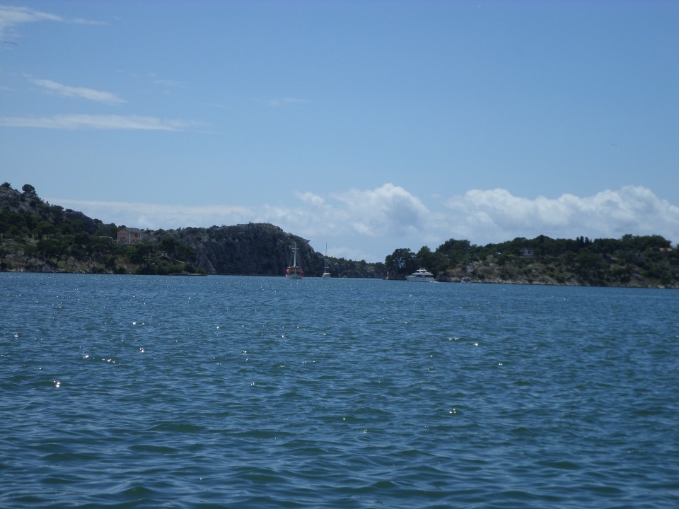
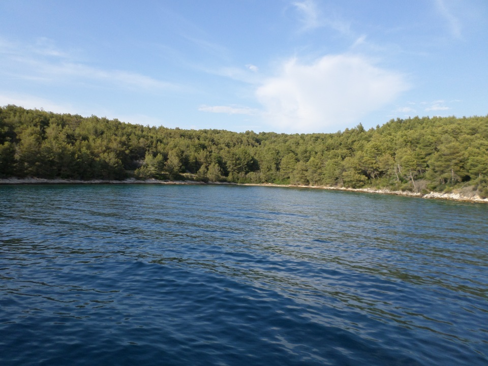
We bought a sandwich (long roll) for lunch and ate in a green park near the bus stop. From Stračin, we were driven to Sibenik, where the Krka River estuary forms a sheltered by shallow bay, with a narrow access to the sea. In the past this was protected by a couple of towers and could be blocked by a chain across the entrance. The photograph below shows the narrow entrance in the centre of the view, but the towers are now in ruins.
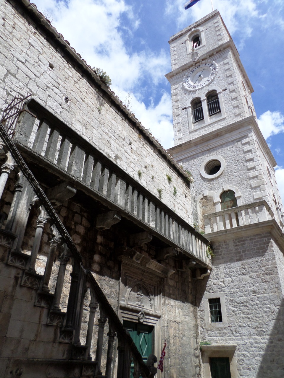
It was good to visit Sibenik again, this time with an actual local guide, who pointed out a few things that Ana had missed (or I had missed her pointing out). Sibenik was first mentioned in official documents in 1066, and it is the Croatian King of that time whose (modern) statue fronts the park through which we walked up to the old town.
The new Library building incorporates the remains of the old city wall, and forms the left side of the main gateway to the old city. The gateway itself and the rest of the city wall no longer exists, having been robbed out for other buildings.
We walked down the more up-hill of the two main streets, passing a small church of Saint Ivan with a lovely relief carving over the door, and an unusual arrangement of stairs and balcony outside the church.
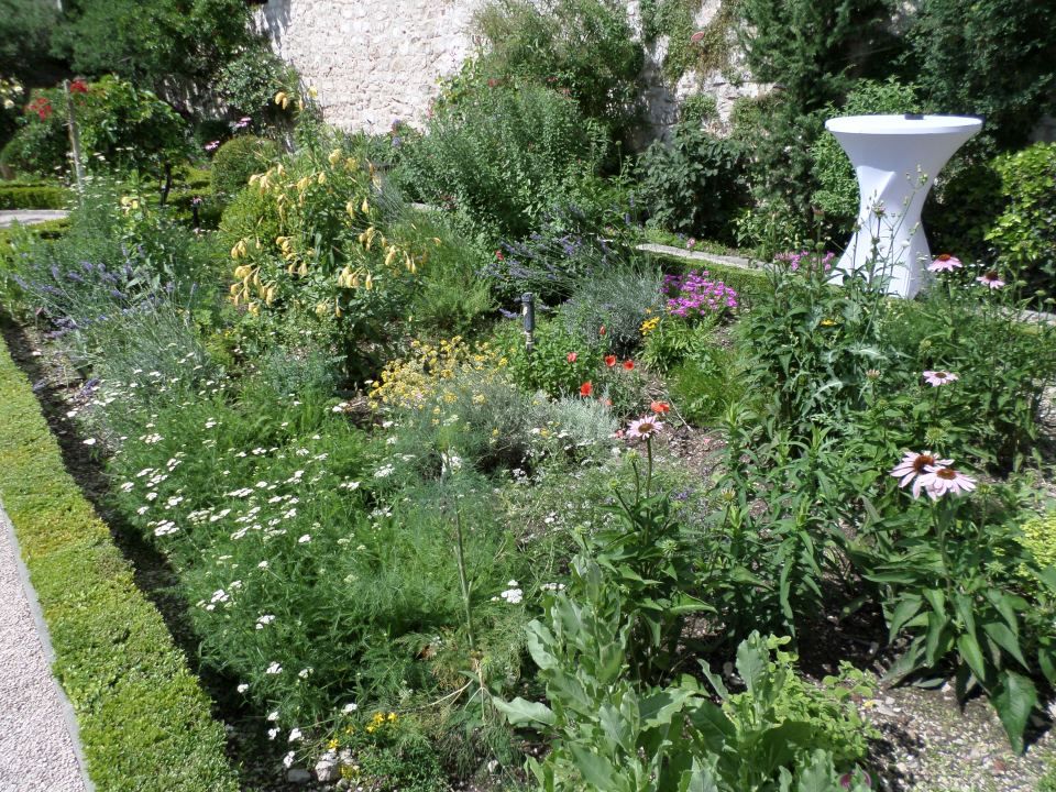
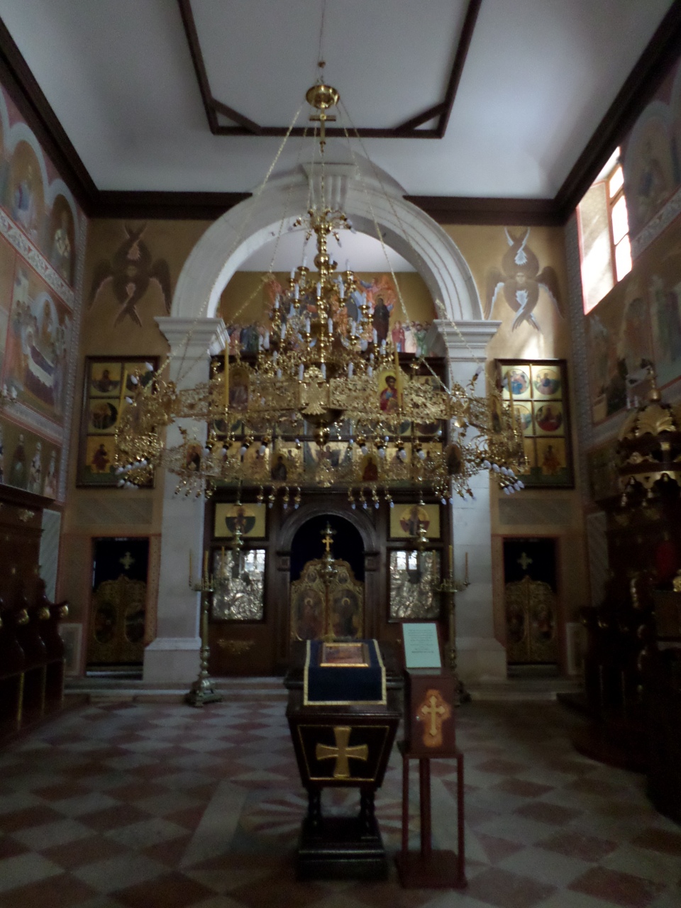
We visited the Cathedral again, with its amazing carved faces, and elaborate columns flanking the main doors. The church was set up for a wedding, but we were allowed in, admired the nave roof (all of stone) and were led down to admire the carving in the Baptistry. Given free time, we immediately climbed up the stairs to the Herb Garden of the St Lawrence Monastery. The associated cafe was being set up for a wedding reception, but we were allowed in (I gasped out that we only wanted to look at the garden). It is set out in a rectangle with a fountain in the middle and the four quarters growing various herbs and flowers. The monastery is Franciscan, established in the late 17th century.
We wandered a bit more and stopped for a drink at a cafe outside the Orthodox Church, which is heavily gilded.
Soon, we had to rejoin the bus and return to Trogir, stopping on the way to look over the bay to Primošten, as reported in that blog.
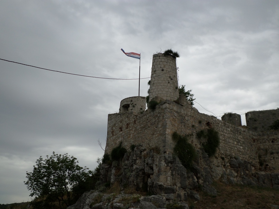
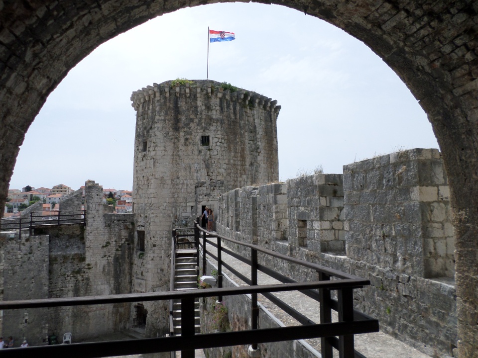
The Klis Fortress
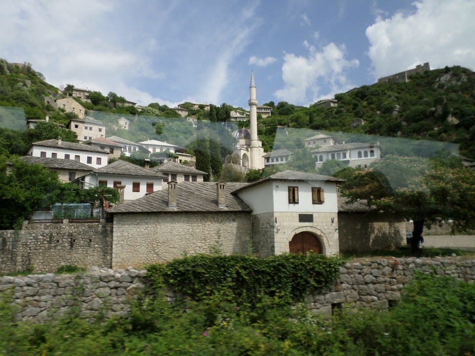
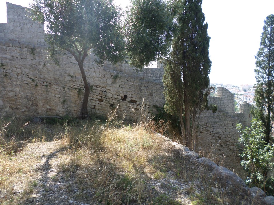
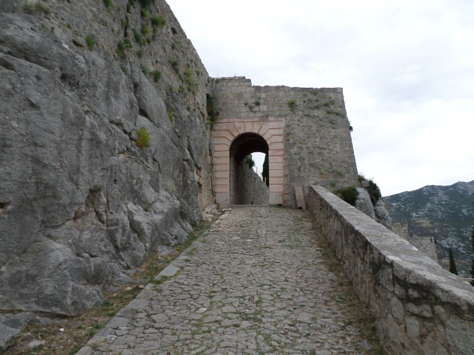
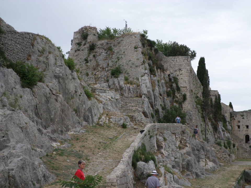
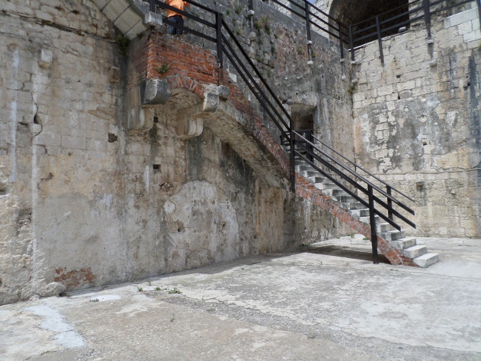
The Fortress of Klis is on a ridge above the approaches from the mountains behind Split. We visited Klis on the afternoon of 8th June. We were dropped off below the Fortress, and climbed up a steep roadway round the point of the Fortress and up to the first gate.
Both the first and the second gates appeared to have been reconstructed more recently than the original stonework, using larger, redder blocks.
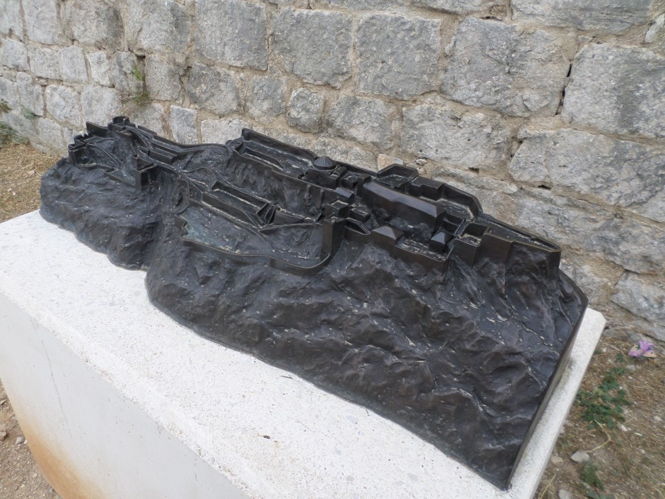
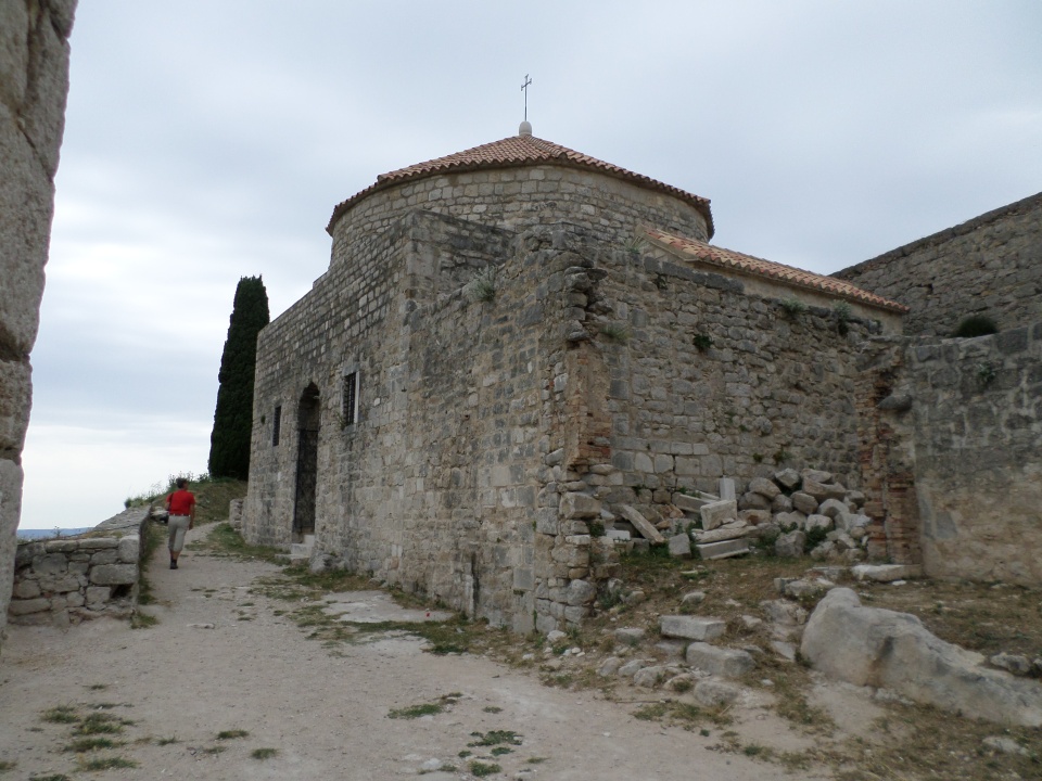
A model of the Fortress shows the long, narrow shape of it, on different levels. This reflects its stages of construction and changing fortunes as it changed hands several times. First it is believed to have been a tribal stronghold of the Dalmatae tribe, almost two thousand years ago. It has been rebuilt and developed over the centuries as a seat of Croatian kings and a defence against the Ottoman advances in the area.
We entered at the far left!
It can be hard to tell which bits are rock and which bits are built.
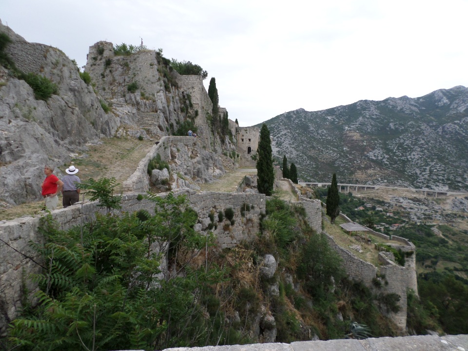
The fortress was used as a set for scenes from game of Thrones, but it was not clear what scenes involving which characters. There had been a display at the Fortress presenting information about this, but it burnt down and has not been reconstituted. Apparently it was in Season 4, Episode 4, involving Daenerys Targaryen entering a city with a large pyramid (added to Klis by CGI!).
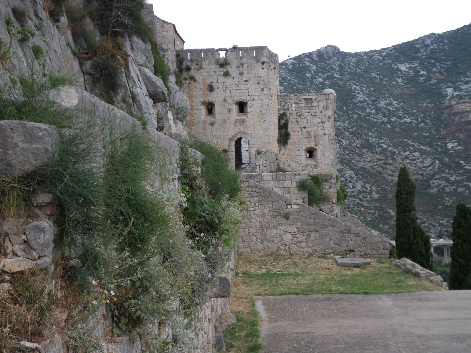
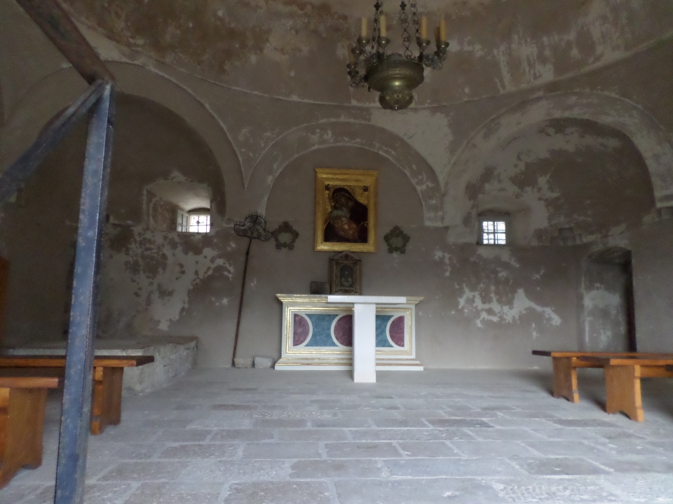
There is a church in the fortress, which since it was in Turkish hands from 1537 until captured by the Venetians in 1669, was also a Mosque at one period in its history.
There is also a museum with examples of various styles of armour, arms and traditional uniforms (but photography was not allowed).
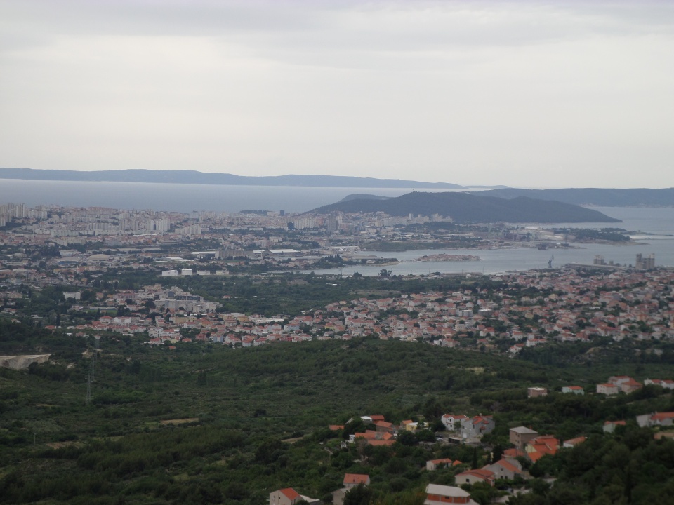
The view towards Split was magnificent, but of course from this direction we could see only blocks of apartments and not Diocletian’s Palace, on the other side of the isthmus.
The ‘prow’ of the Fortress pointing roughly south-east (I think) gave a good view back to the city along the line of the Fortress. The village of Klis clings to the hillside below the fortress.
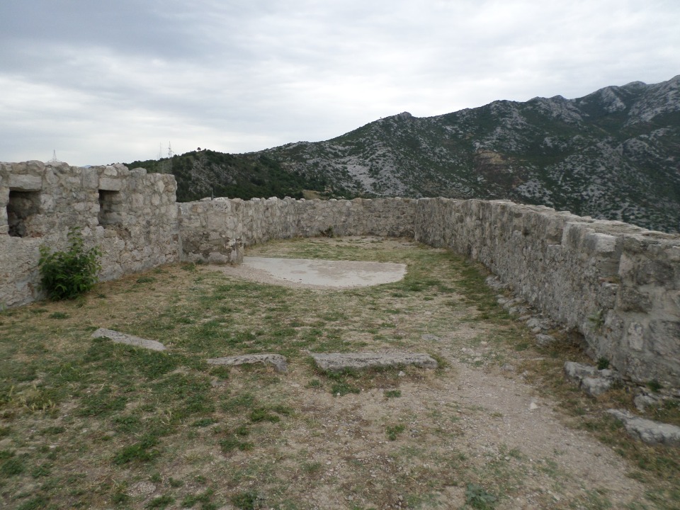
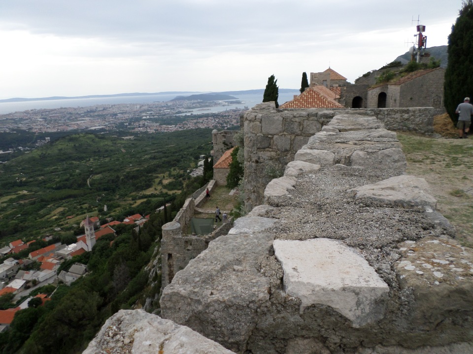
We did not have long to explore, but got a good idea of the strategic importance of the fortress in past centuries. It has fallen somewhat into ruin, and this certainly allows for dramatic scenes. The views are amazing.
Exploring Trogir
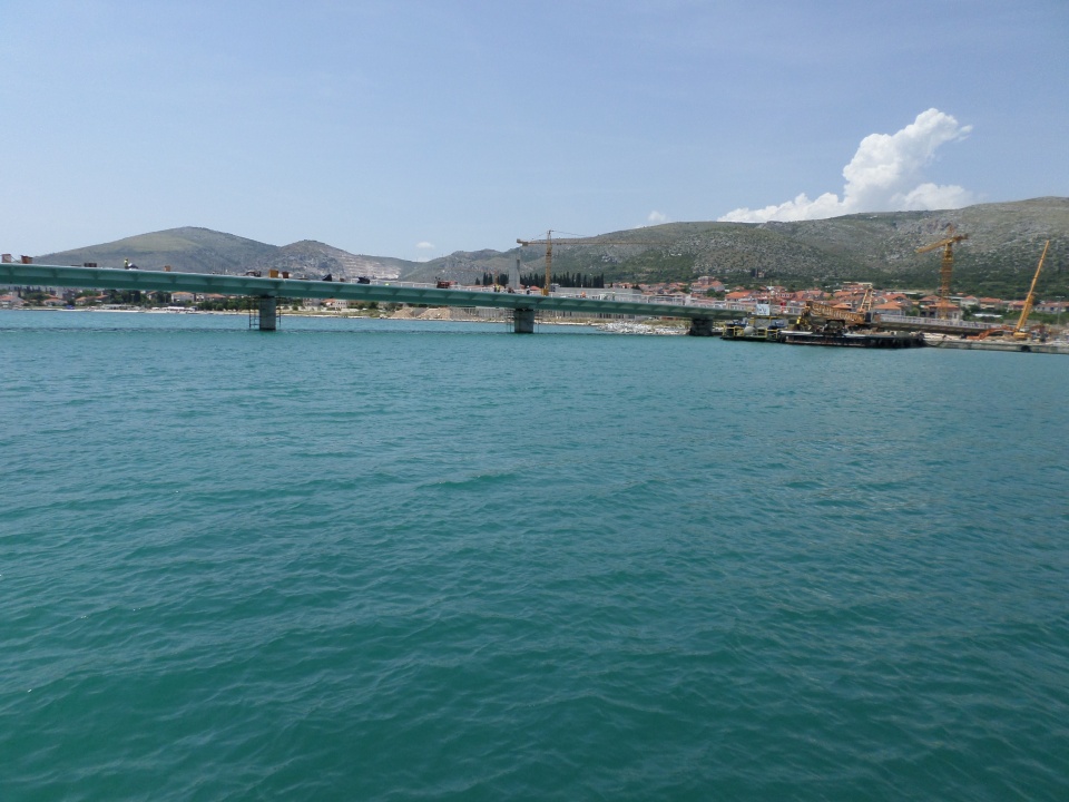
On our last day in Split, we went out early to photograph more of the places that we had visited before crowds filled them. We packed and left our lovely apartment and caught a little ferry boat to Trogir, an hour’s ride away to the west.
The ferry boat went under the new bridge being built from the mainland to the big island on the other side of Trogir. As we found out later, Trogir is a small island and its bridges link the further island with the mainland. Thus it is a real bottleneck. The new bridge should fix that. However, there have been problems building it, and it is way over budget and time. The ferry only just fitted under it.
It was only a short walk from the ferry wharf to our hotel, visible from the ferry. That evening we met with our tour group and Sibila, our fearless leader, followed by a meal at a restaurant on the promenade of Trogir. The ‘fruit cup’ that we ordered turned out to be three scoops of ice-cream!
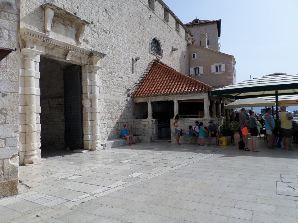
The next morning (8th June) we had a walking tour of Trogir with a local guide. First we were told some history. Interestingly, Trogir was originally a Greek settlement, under a colony on the nearby island of Vis, which itself was settled from Syracuse. It became part of the Roman province of Dalmatia, was independent for a while, then came under Venetian rule, briefly French and then Austro-Hungarian, becoming part of Yugoslavia after that – like so many of the coastal towns.

As an island Trogir was defensible, and was walled – the walls can still be seen in places, especially the south side of the town. The South gate into the town has a logia outside the gate to shelter travellers who arrived after the gates had closed for the night.
Of the north wall, only the main gate remains.
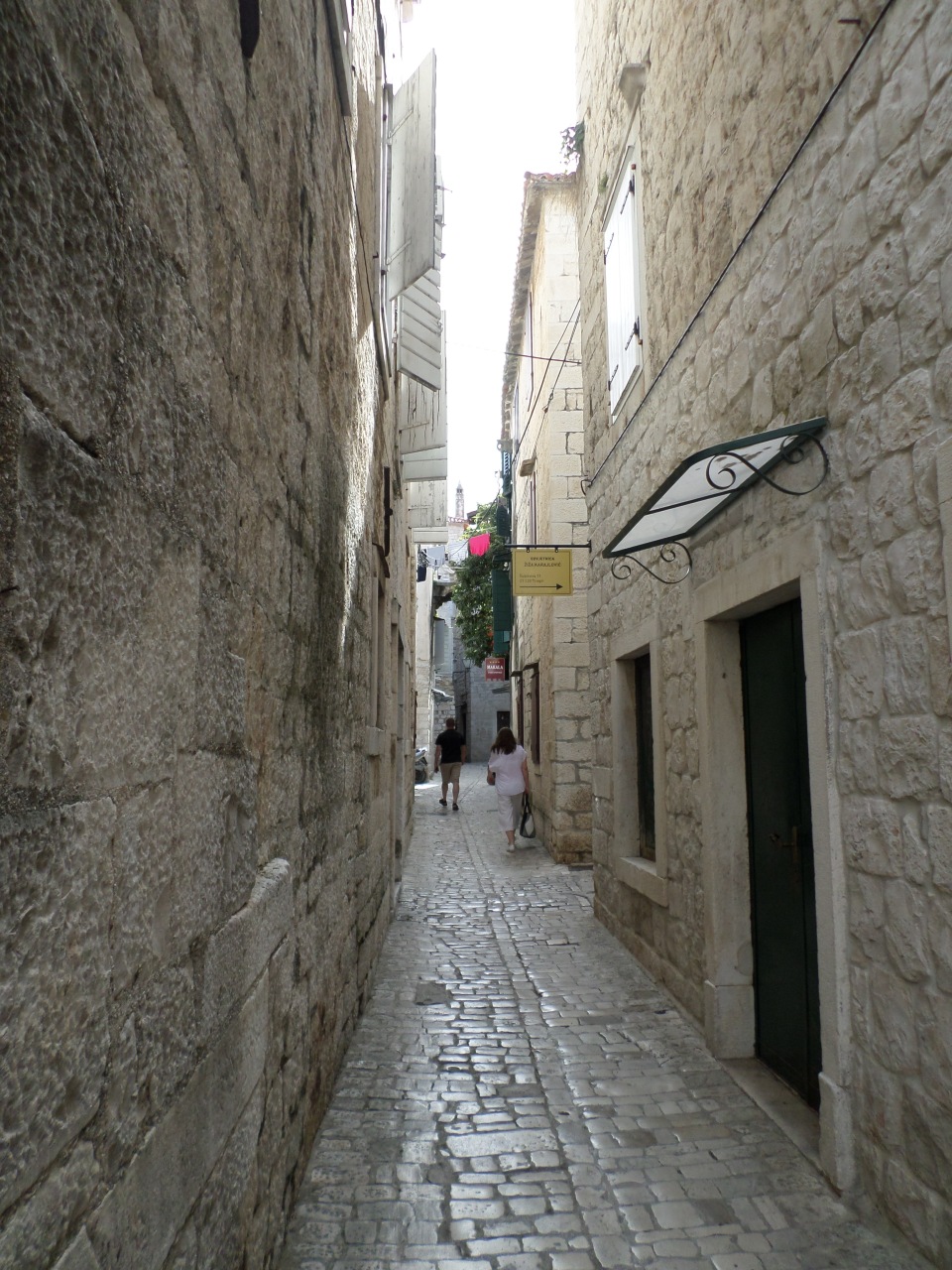
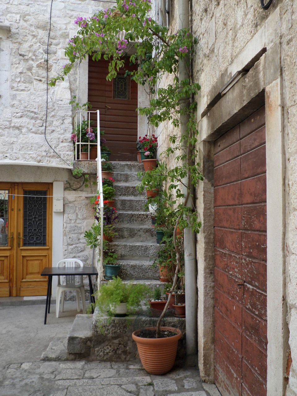
The medieval building on the Hellenic/Roman street plan has been preserved, and this has led to the UNESCO listing of the town. Like many medieval towns, the ‘streets’ are more like narrow alley-ways, narrow with three of four storey buildings on each side, breaking into unpredictable plazas, now often filled with cafe tables and umbrellas.
The Cathedral was noted on the UNESCO submission. It looks quite plain on the outside, but has amazing carving round the main door. This dates from the 13th century, and was done by several different artists, as evidenced by the different levels of detail in different concentric arches.
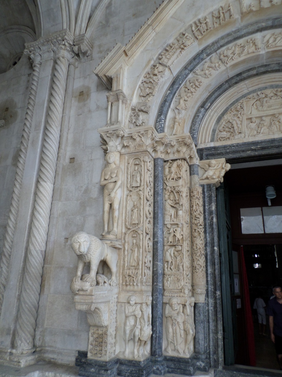
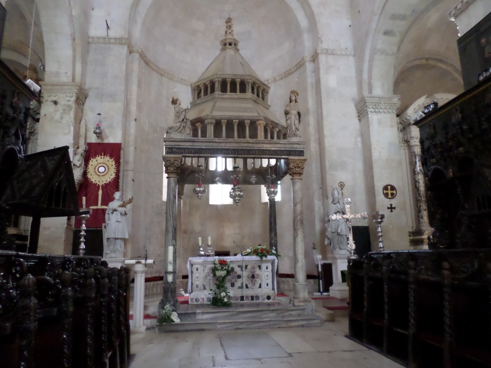
Inside are vaulted ceilings, artistic side chapels and rich altar decorations, but the walls and Chancel were fairly plain. The Treasury displayed reliquaries and ancient books as well as crosses and crosiers. The north aisle chapel commemorates the plague, with a black background to the crucifix and featuring skull and crossed bones.
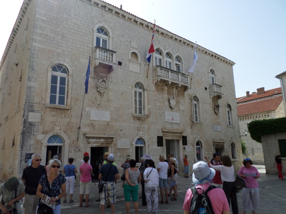
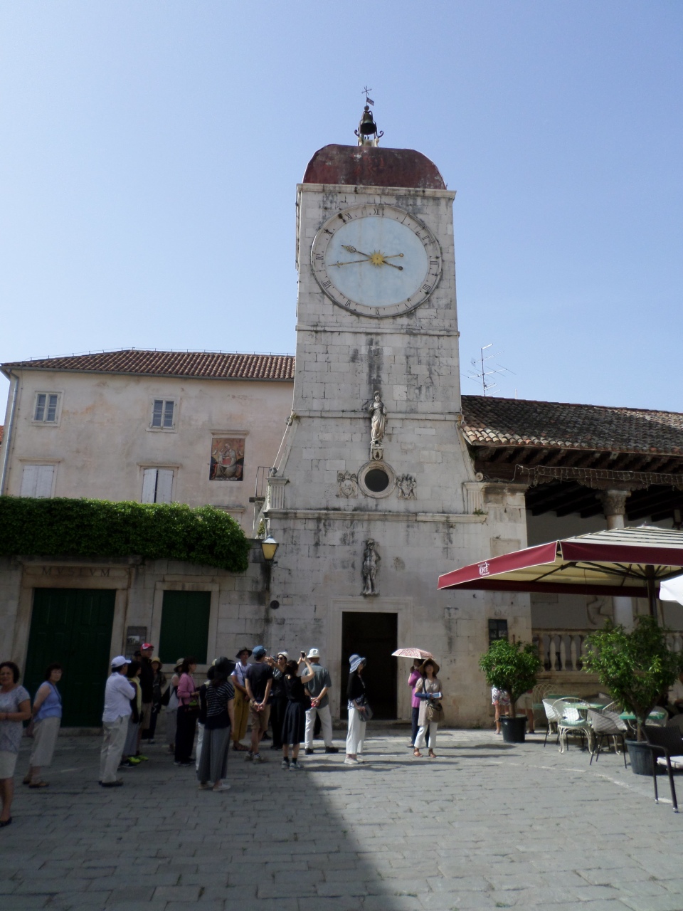
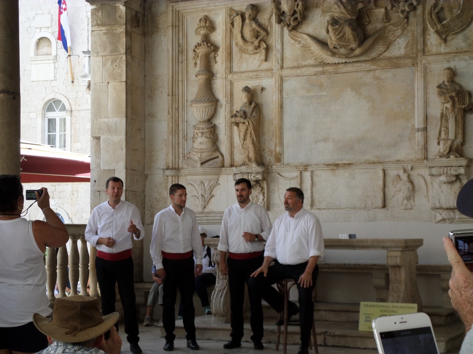
Facing the piazza beside the Cathedral was the Town Hall a clock tower and an open loggia where legal cases were once heard, now it is used by klappa groups to wow the tourists.
There was also facing the piazza, a rather impressive, Venetian influenced building that was probably the palace of an influential noble family once, now it housed a souvenir shop, at least on the ground floor.
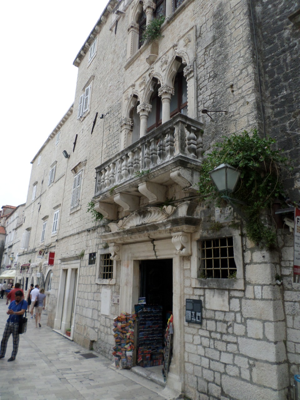
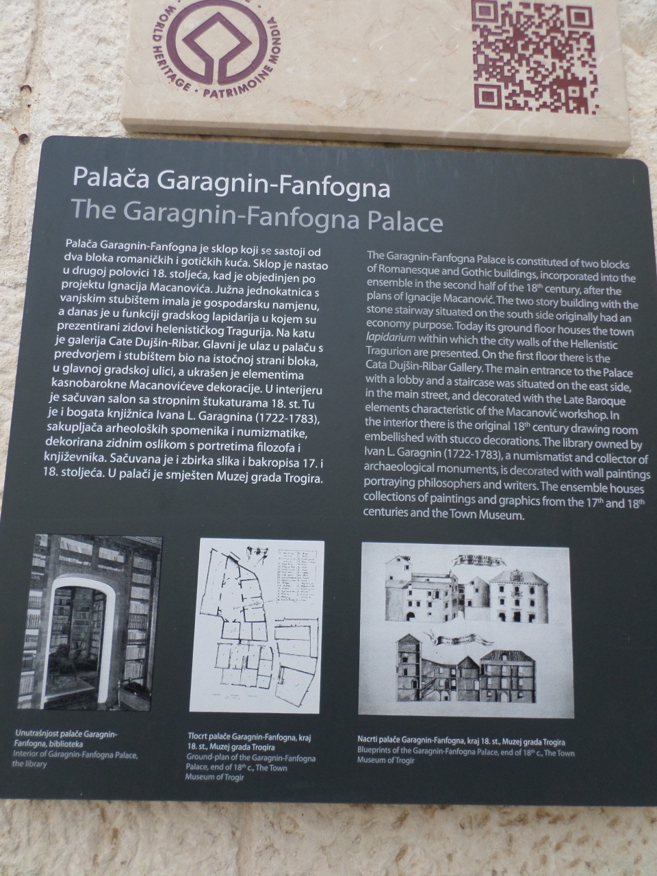
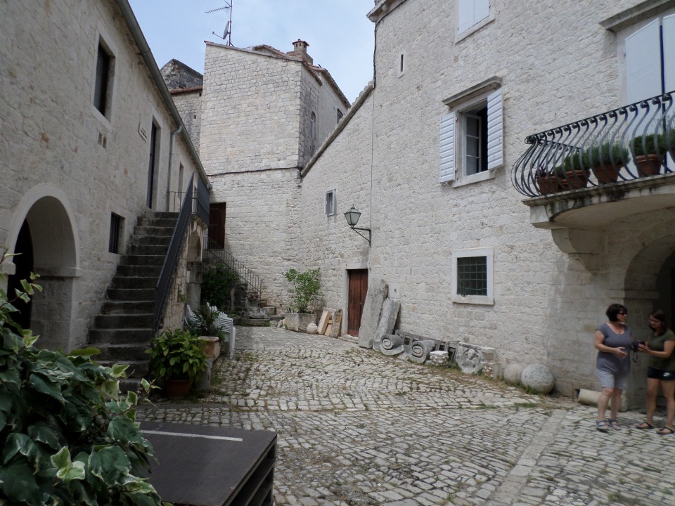
In our free time we headed for the museum opposite the main (northern) gate. This is housed in a Palace of a noble family, the Garagnin-Fanfogna family. The Palace was actually an amalgam of several buildings acquired by the family over the centuries. It had an open atrium and several staircases leading to different areas of the Palace, now different exhibition areas
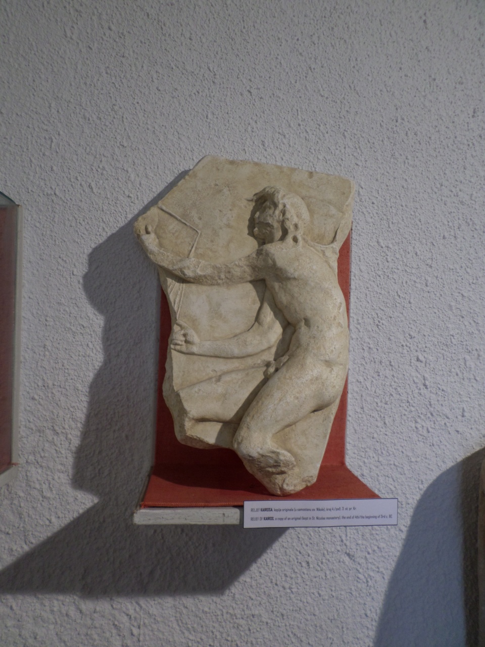
The displays included bits of decorated masonry that evidenced the Greek and Roman heritage of the town. This includes a ‘kairos’ or Greek winged figure that dates from the 3rd century BC.
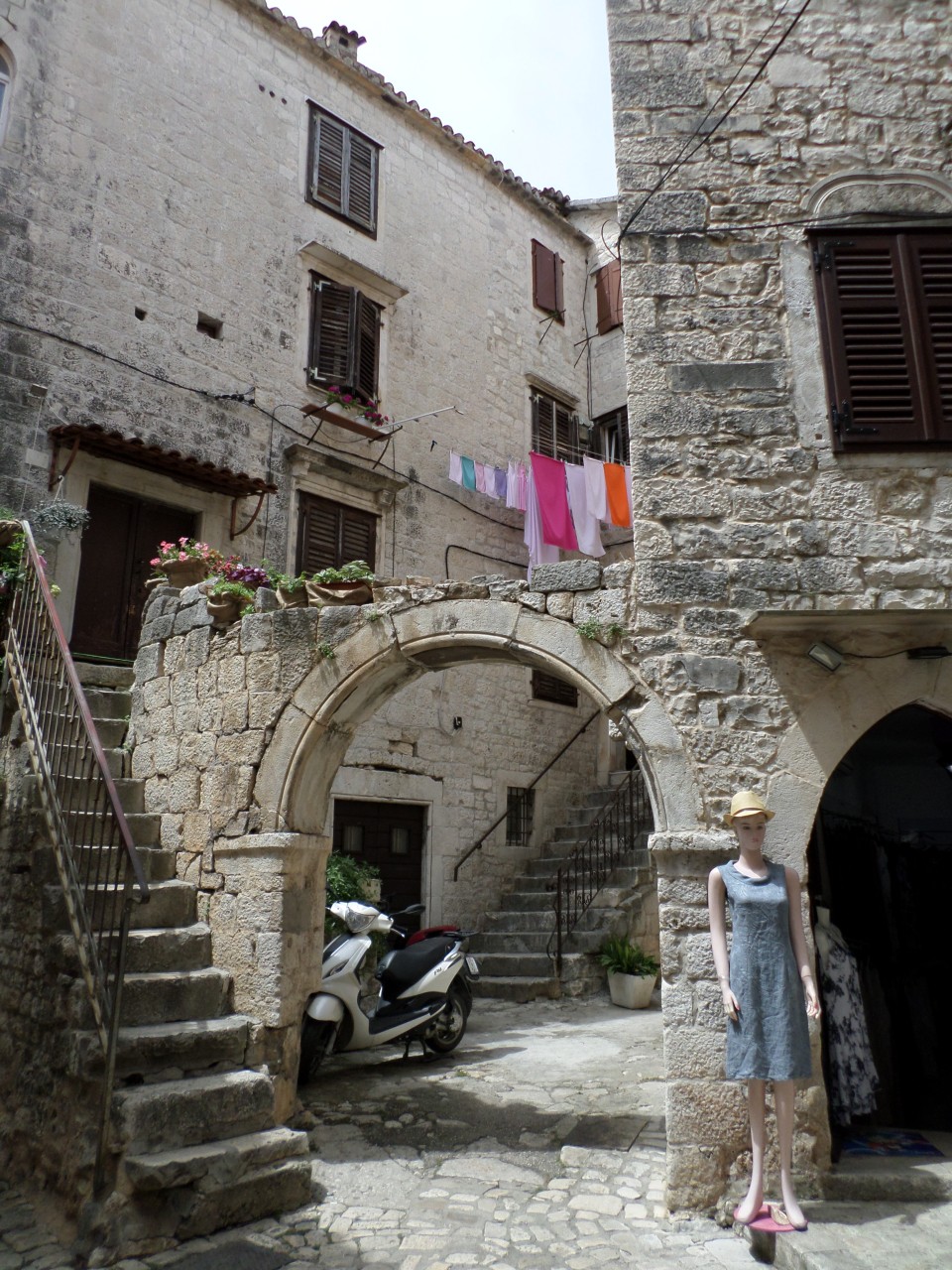
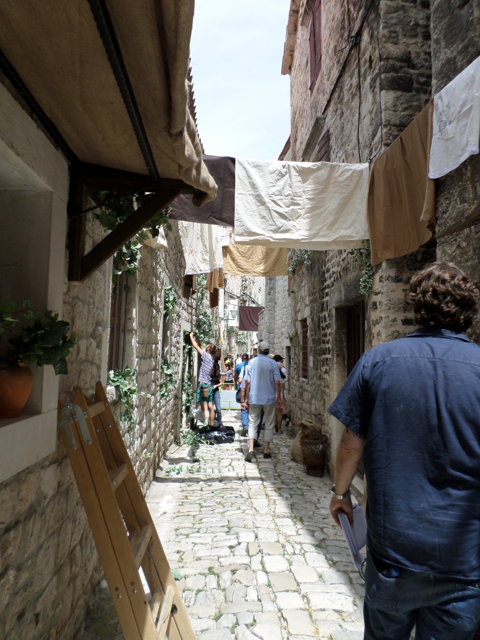
After exploring the Museum, we wandered the streets, and found a film crew decorating the streets as their set for some film or TV show. The alley was strewn with straw, ivy was draped decoratively round doorways and ‘washing’ was hung from lines to disguise modern features. Generally the alleys were interesting for the unexpected stairways and arches, and the slippery and uneven cobble stones.
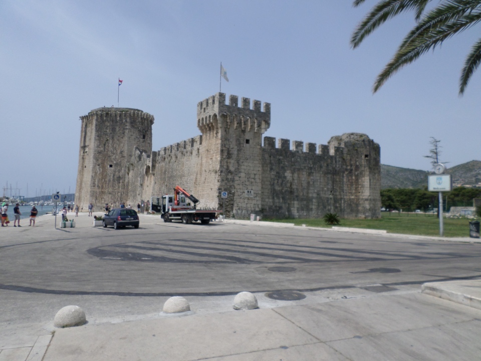
We got as far as the Kamerlengo Fortress at the west end of the island, which was constructed in the 15th century, after Trogir became part of the Venetian Empire. Now it is fairly much a shell, but with an arched staircase up to the walls.
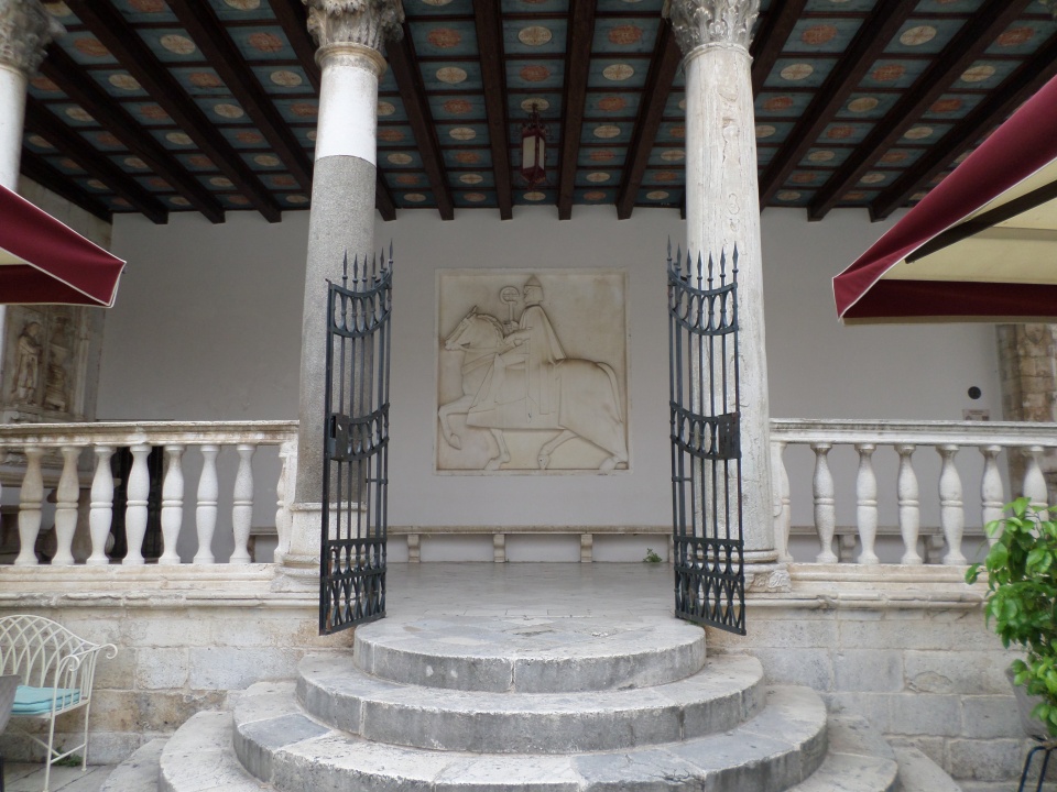
Walking back to join the rest of our group, I got a shot of the logia, showing the relief of a horseman and the painted ceiling.
Sailing to Brač
Our third day in Split (6th June) and we had booked onto a boat trip out to the island of Brač. The ‘c’ has a curve over it, indicating that it is pronounced as ch. We started out a bit early, to go through Diocletian’s Palace to get some photos before the crowds built up.
The boat was a large catamaran with tables and benches under sun protection and some open area at the prow, as well as a net between the pontoons, that were forbidden while the boat was moving. As we boarded, we headed for the area most likely to be in the shade all day, the British (and other) tourists headed for the unprotected front of the boat.
It turned out that the bar opened for free drinks from almost as soon as we left port. We were sitting behind a group of nine or ten Britons, who were getting multiple pints of beer – but seemed only happy for it. Maybe they had been in training. We were also offered ‘breakfast’, a large salad roll, which we stashed for later consumption. We had looked at the itinerary the night before and discovered lunch would not be served until 4 pm!
It was only an hour of easy sailing to get to Supetar, the closest port on the northern shore of Brač. Here, we all got off the boat and onto a bus (and the overflow onto a smaller bus) for our tour of Brač. A different load of people got onto the boat, to sail round the island.
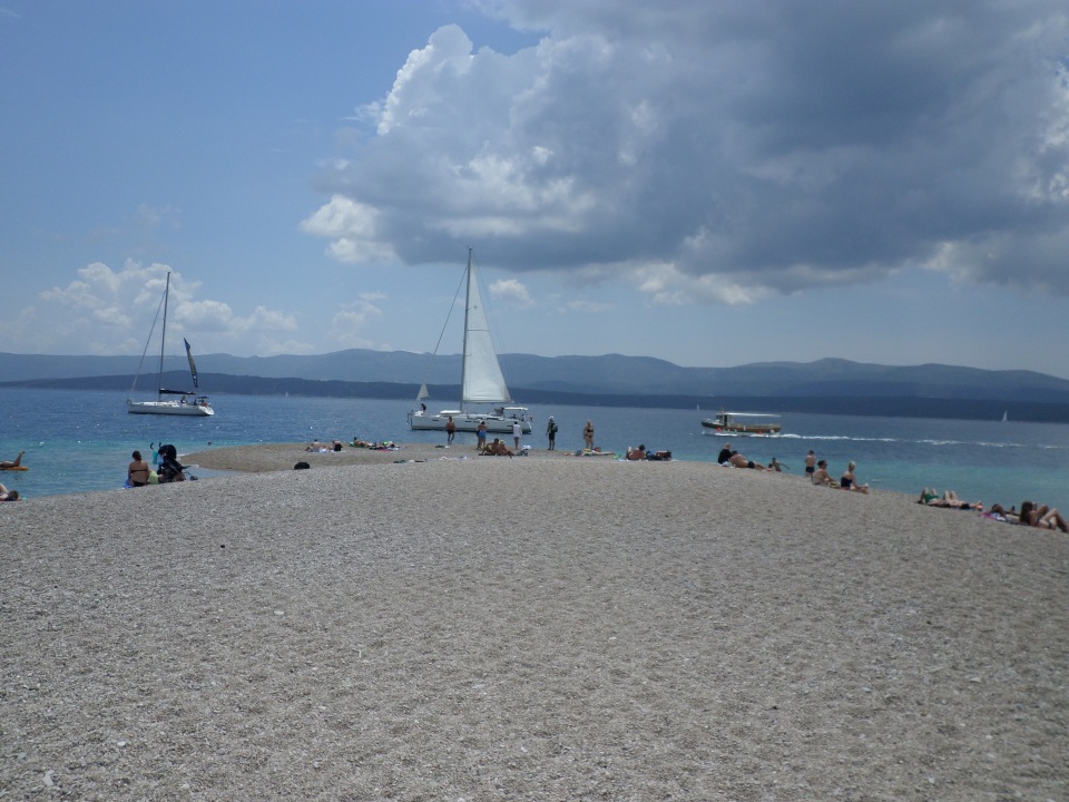
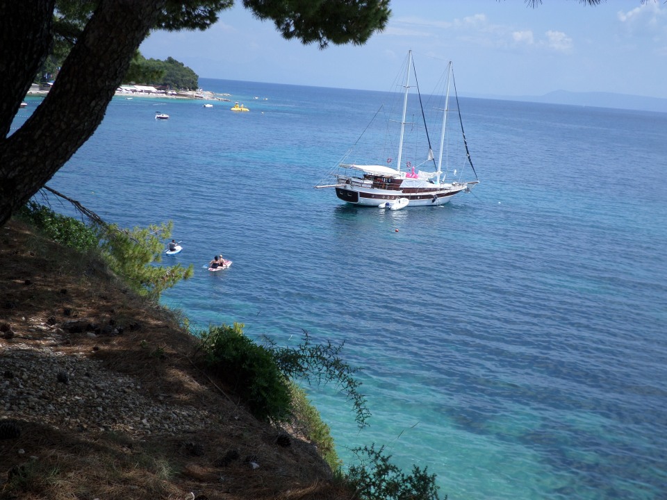
Our bus took us through the town, with some commentary by our guide from the boat, and up the tallest mountain, Vidova Gora. At 780 metres, I think it is also the tallest mountain in the islands. The road up was narrow and went through a forest of low pine trees. We got out of the bus near the summit and walked the last bit, up to a cleared area with lovely views to the south, down to the coast and the ‘Golden Horn’, a shingle spur of beach, and over to Hvar, the next island.
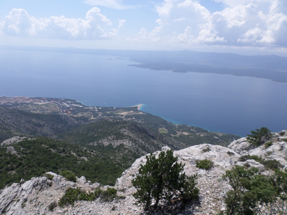
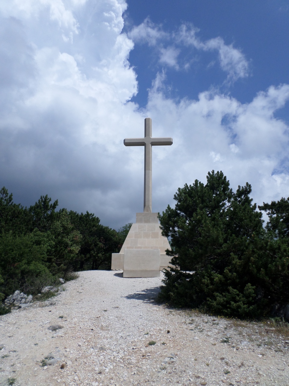
There was what looked like a memorial cross on the mountain top, but it was in Croatian and untranslated-able, except for two dates, 1934 and 1944. Later searches on Google only told us that there are lots of crosses on Croatian mountain-tops.
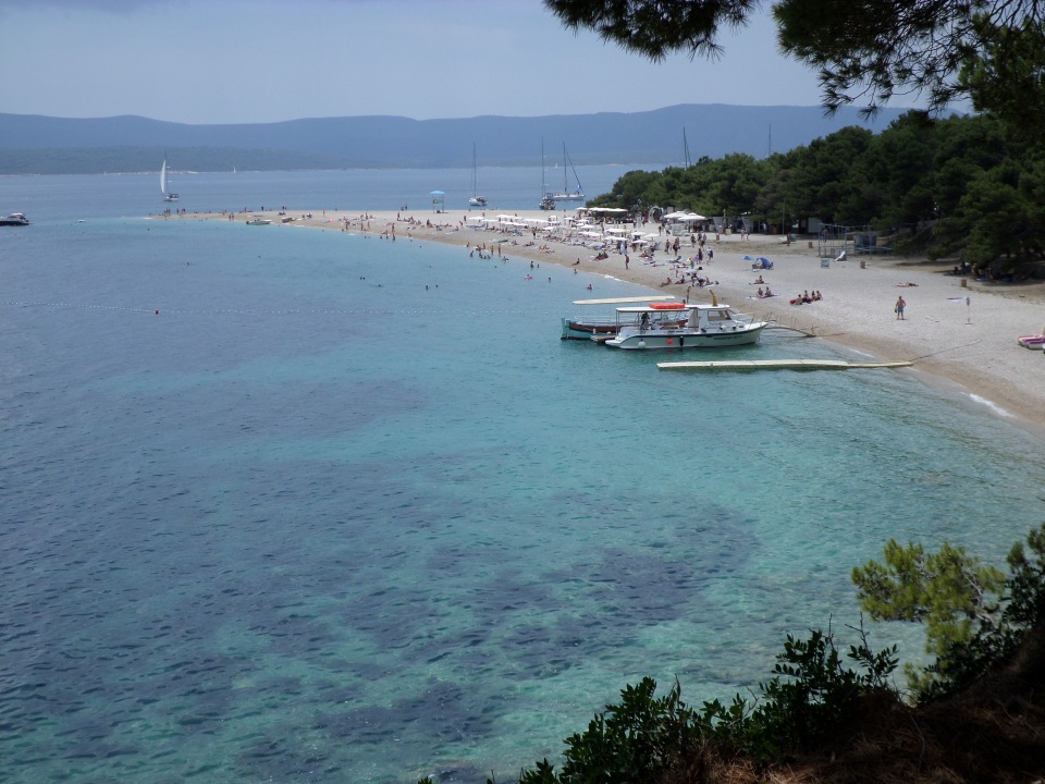
Back on the bus we proceeded down the mountain again and across the island. We drove past an extensive vineyard, olive groves and more piny scrub. Brač is the place where limestone was mined for Diocletian’s Palace and for the USA’s White House as well as many Croatian buildings; we were able to see a quarry from the bus. We were dropped in the parking lot of the Golden Horn beach, I was intrigued by the trellises of grape vines that were set up to keep the parked cars in shade, but left little head-room for people getting in and out. We were instructed to return to the bus there, or meet the boat in Bol, a town only a kilometer or so away. Shirley and I wandered down to the beach and ate our ‘breakfast’ rolls, then walked out onto the horn. What looks like golden sand from the mountain top was actually shingle. Shirley went in for a dip, while I found the water far too cold and the shingle far too uncomfortable for the feet.
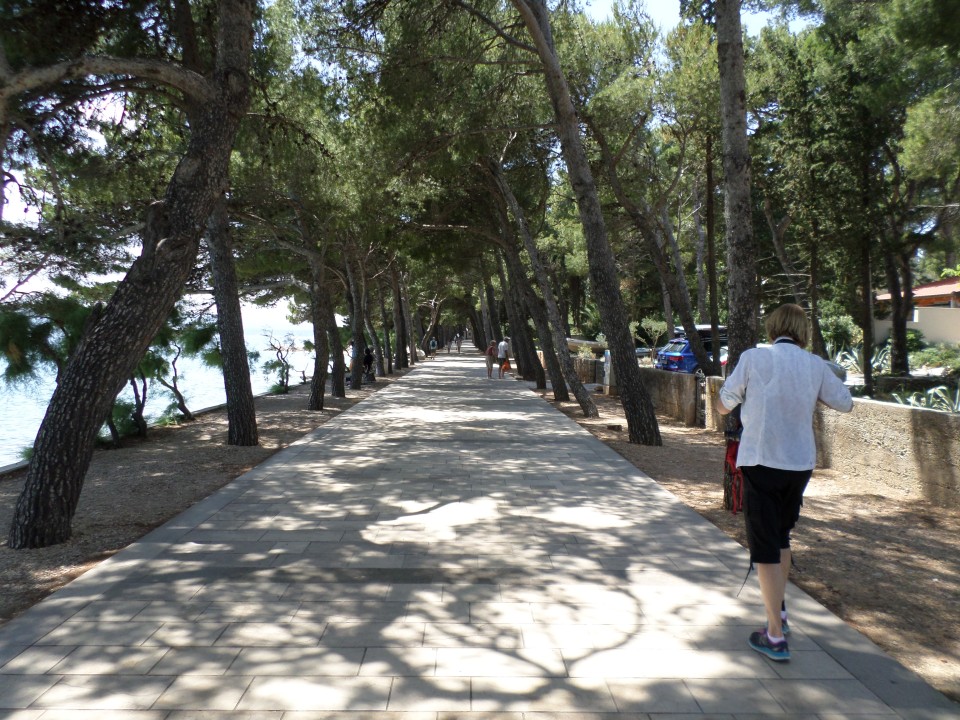
Instead, we walked along the promenade that leads to Bol. This gave us a slightly more elevated view of the beach and a shady walk on a paved path.
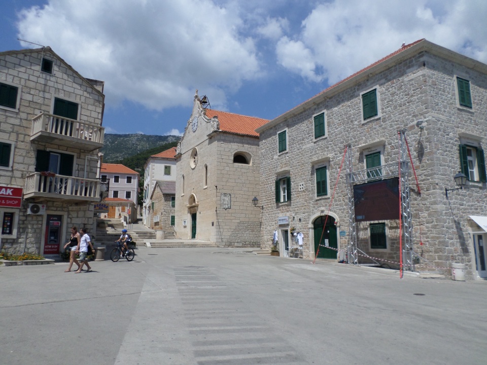
We got to Bol, only to find it baking hot in the middle of the day. All the surfaces seemed to reflect the heat. There were a number of shops and restaurants, and also appeared to be a Town Hall above the harbour.
After a brief exploration, we walked back onto the Promenade and looked for a gelato vendor. We were nearly back at the beach before we found one. However, it was a nice walk, so worth it.We sat in the shade to eat it and cool down, watching the water.
We then walked back to Bol, met the rest of the group and re-boarded the boat, after the travellers who had boarded in Supetar alighted and the crew quickly cleaned up. Once again the bar was open almost as soon as we sailed. We headed west along the south coast of Brač, which looks fairly deserted. We saw a few settlements but no apparent continuous road, and at least one large ruin of what had been a substantial building.
We stopped twice for people to swim, and had a salad lunch at the first of these stops, and cake and watermelon at the other, I washed mine down with a glass of wine. The water was crystal clear and very inviting, but not enough for me to swim after feeling how cold it was, earlier.
The boat headed back to Split, and an extrovert American couple got many people (including me) up to dance. It was fun. We were back in Split about 7:30 pm, and spent the evening on our terrace, looking over the roof-tops. It is only writing it up that I realised I did not have a photo of the actual boat!
